Category Archives: 2019 Field

We can’t Th(wait)es to answer your FAQ about Thwaites and Icefin!

Thwaites FAQ: On May 21, 2020, PI and Icefin Lead Scientist Dr. Britney Schmidt participated in a Twitter Q&A session with Bulletin of the Atomic Scientists, and answered some of your most frequently asked questions about Thwaites and Icefin as part of the #ThwaitesGlacierChat. If you’re new to Thwaites and/or Icefin, this is a great place to start! If you’ve been following us for a while, here’s your chance for a more in-depth understanding of what we do, and why it matters.

Bulletin Atomic: The International Thwaites Glacier Collaboration is a 5-year project involving a huge number of scientists, ships, and aircraft to study the Antarctic. Why is this research important? What are you hoping to find?

Dr. Schmidt: Thwaites Glacier is one of the fastest changing glaciers in Antarctica. We want to understand how that works, and how quickly climate change is affecting the glacier. One of the ways to do this is to make measurements up close and personal with the processes affecting the ice, like melting from the warming ocean. 

Bulletin Atomic: What is the difference between sea ice and the ice on land? Do they each contribute to sea-level rise?

Dr. Schmidt: Ice on land (glaciers) is formed from compacting snow, but sea ice forms from ocean freezing. Glaciers like Thwaites enter the ocean below sea level. What this means is that glaciers can be easily affected (melting) by the ocean, and when they speed up, they add ice and water to the ocean, changing sea level. So the melting of sea ice can cause more glacier melting, through warming of the ocean, which means sea level rise. While sea ice doesn’t change sea level, as it melts, the bright ice that reflects sunlight is replaced by dark ocean that absorbs heat, which accelerates ocean warming.

Bulletin Atomic: MELT Project is part of the International Thwaites Glacier Collaboration. What is that project and how does it fit into the overall effort to understand the Thwaites Glacier?

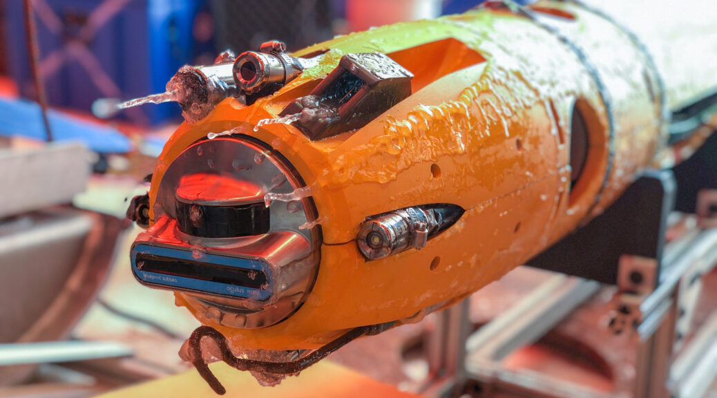
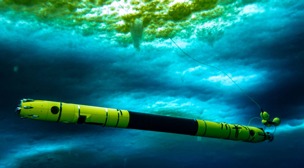
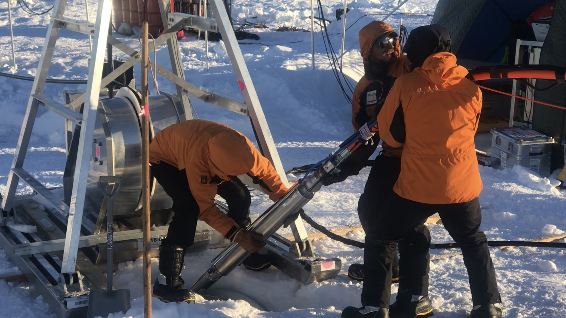
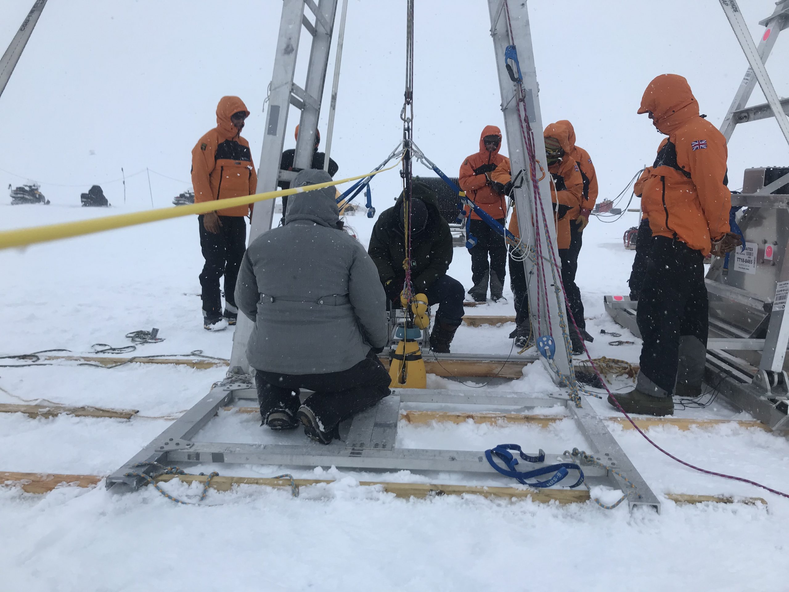
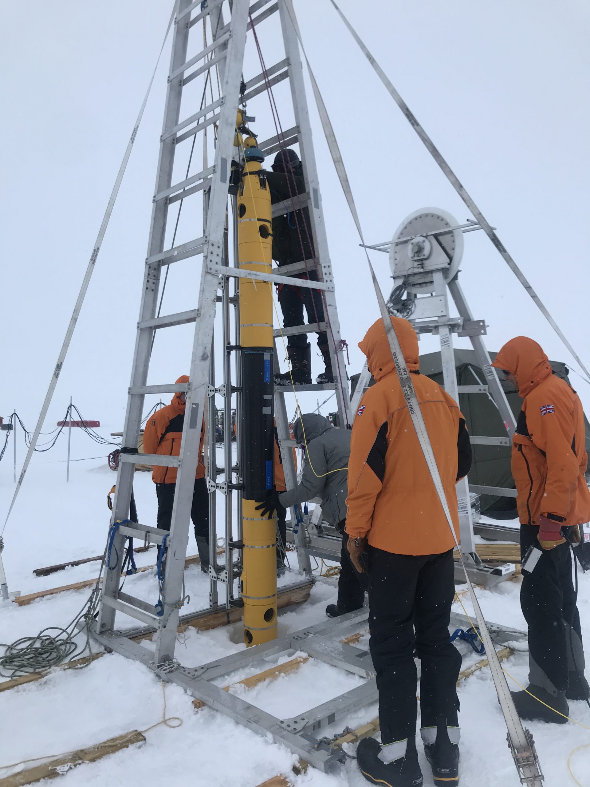
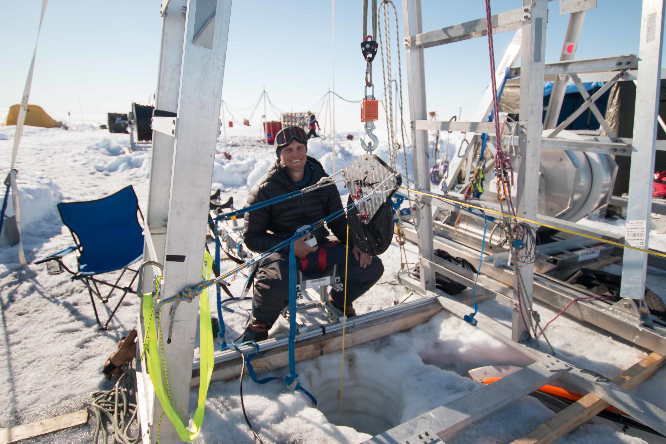
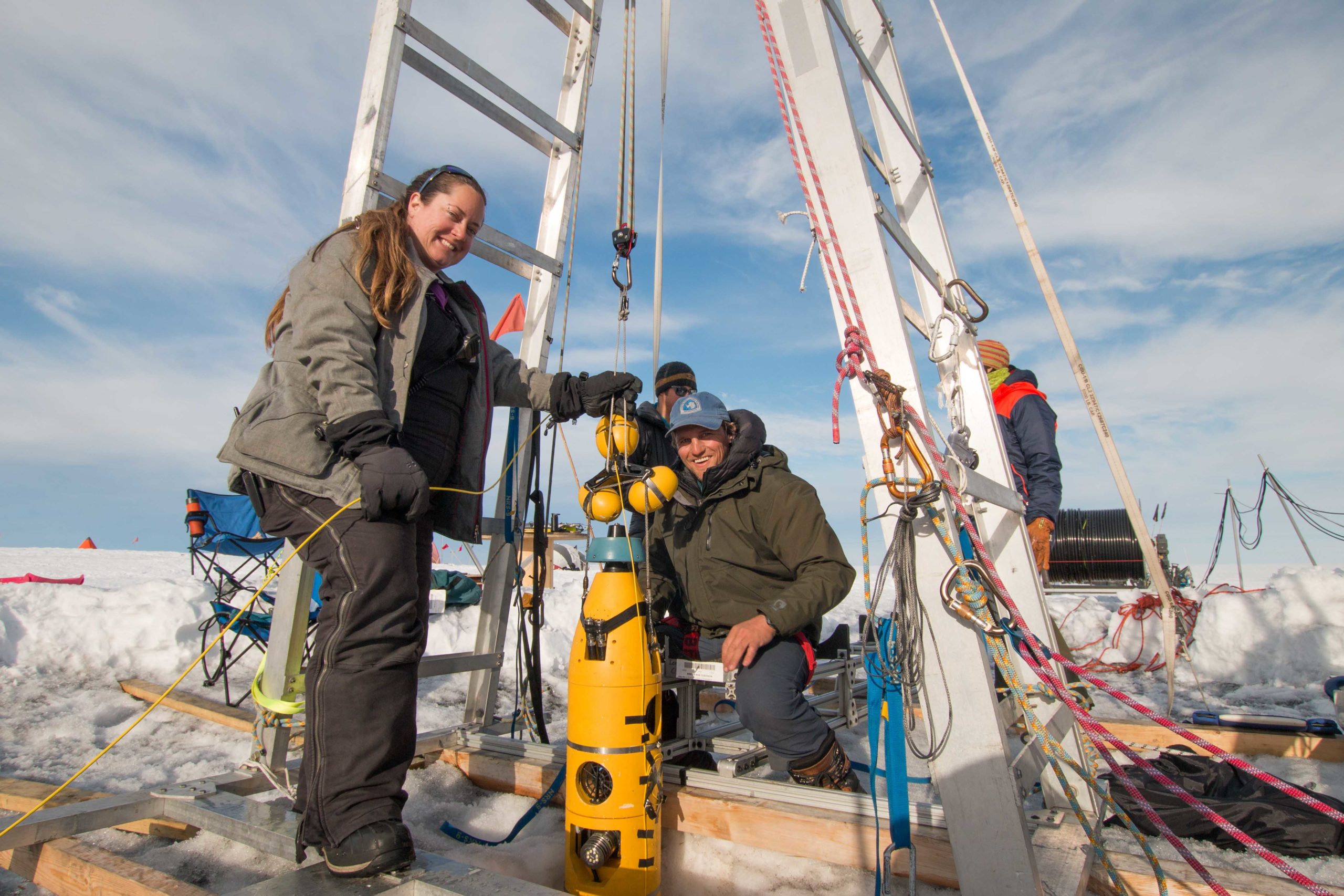
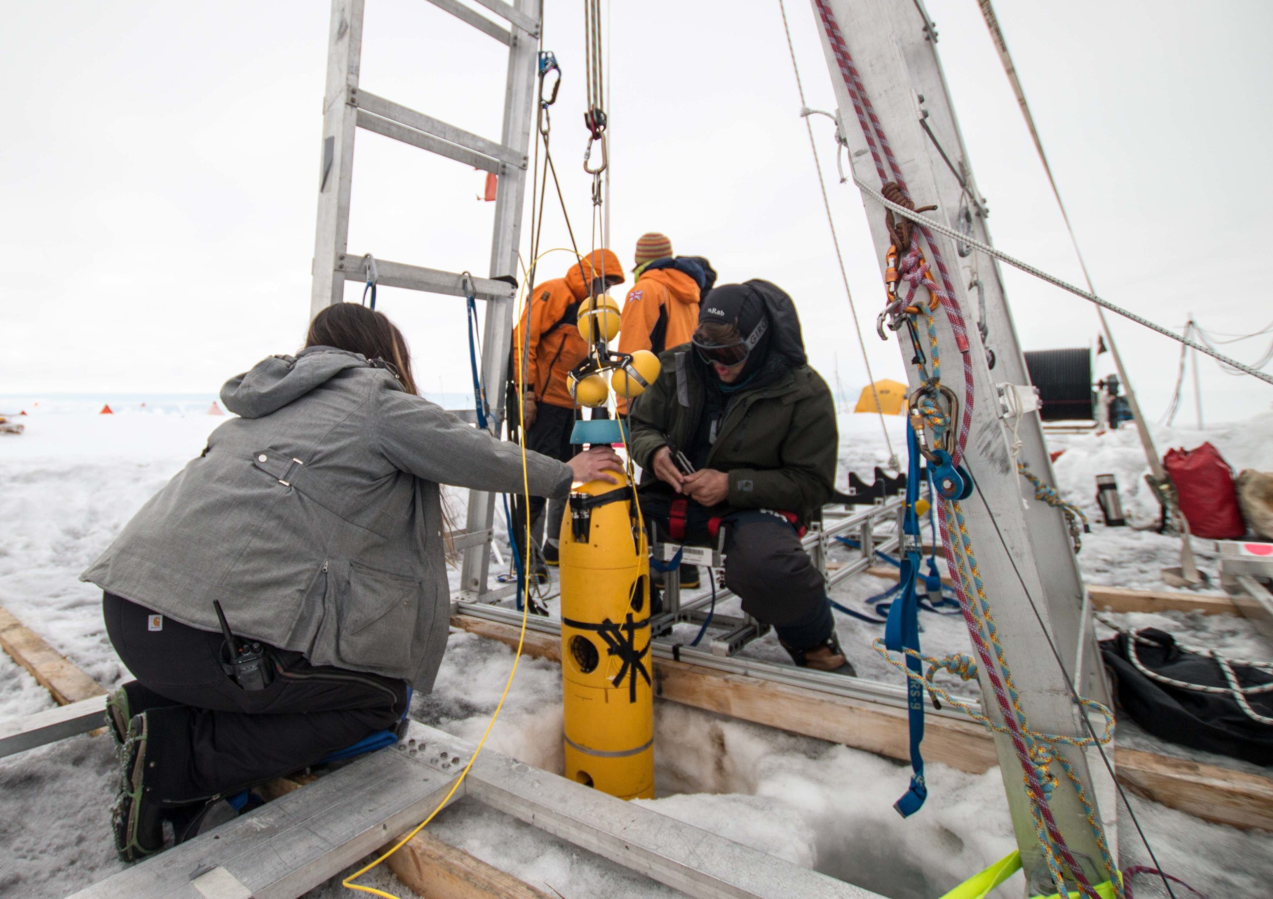
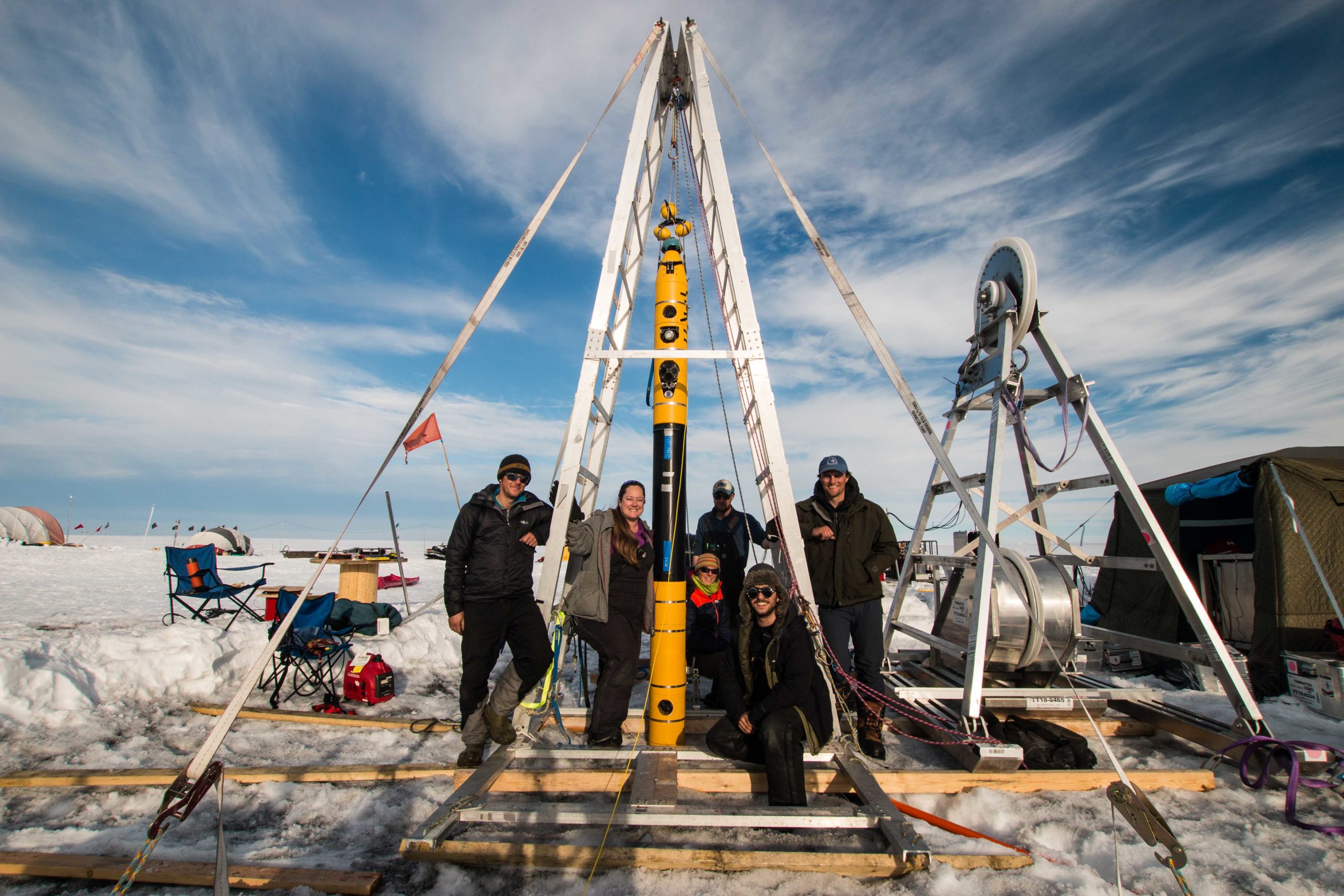
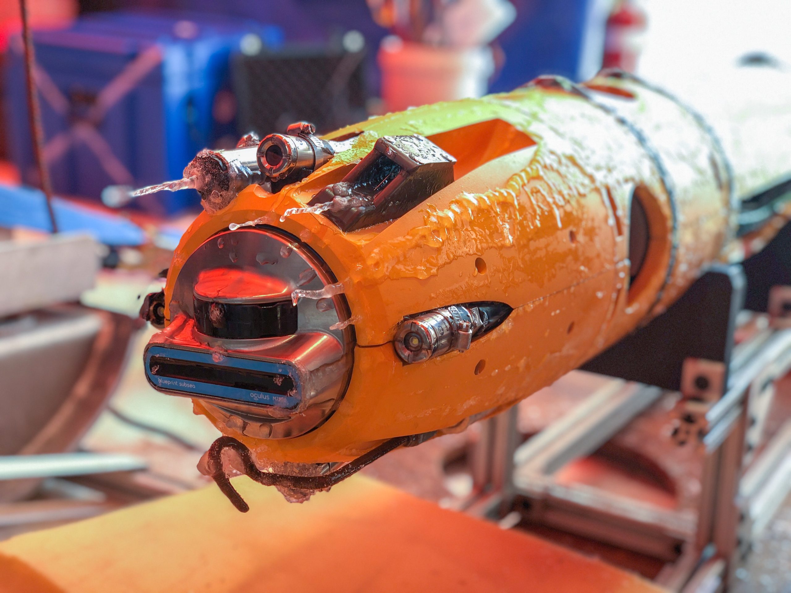
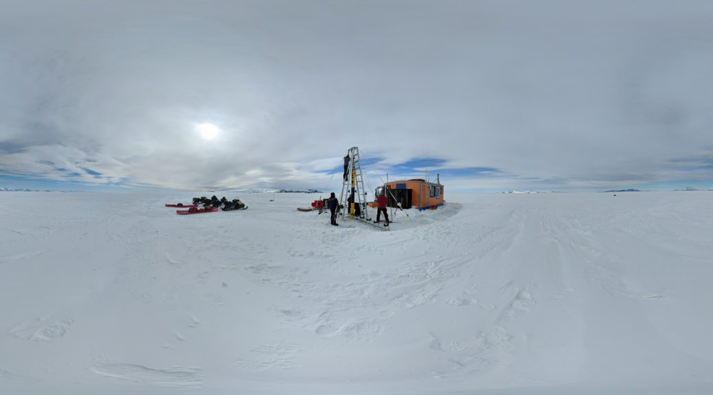
Dr. Schmidt: With MELT, we’re getting up close and personal with the place where sea level rise starts for glaciers like Thwaites — the grounding zone. Icefin used a hot water drilled hole, [drilled] by British Antarctic Survey team Hot Water On Ice, to get under the 600m of ice and swim 2km back to where the glacier starts to float on the ocean (the grounding zone).

Bulletin Atomic: Is the Antarctic melting? All of it? And how do we know?

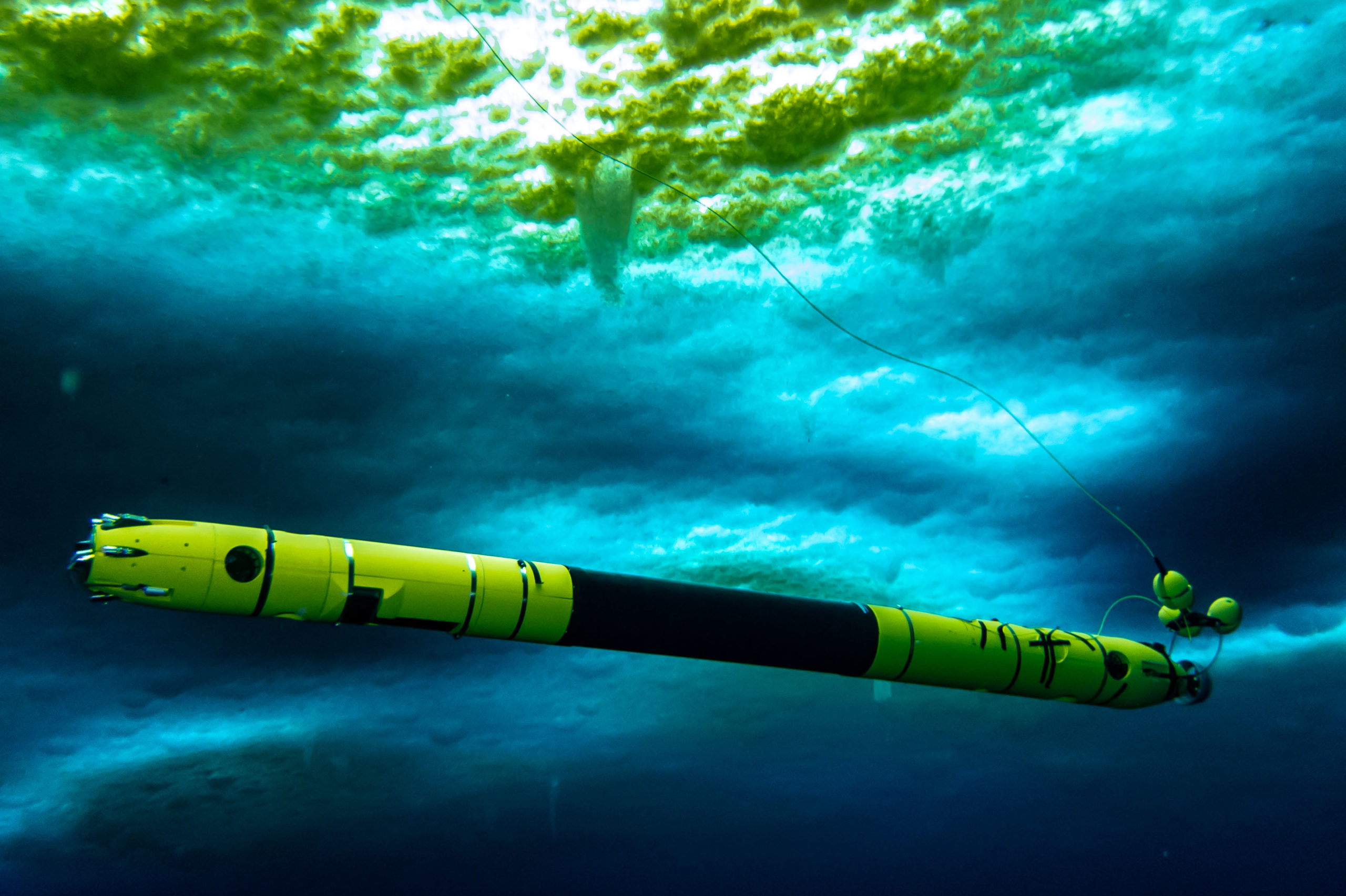
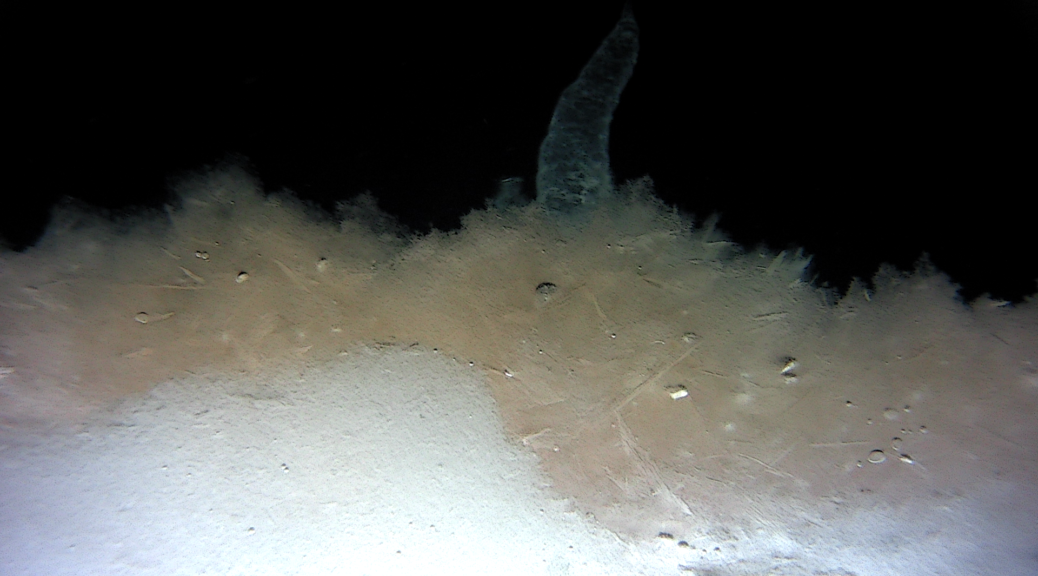
Dr. Schmidt: Quite a lot of melt is happening. We got to see it happening every time we went under the ice at Thwaites Glacier, a lot of which you can see in this video from Icefin here. Here’s our favorite image Icefin took of the grounding zone from under Thwaites, but there are lots more here

An Image Icefin took of the grounding zone from under Thwaites.

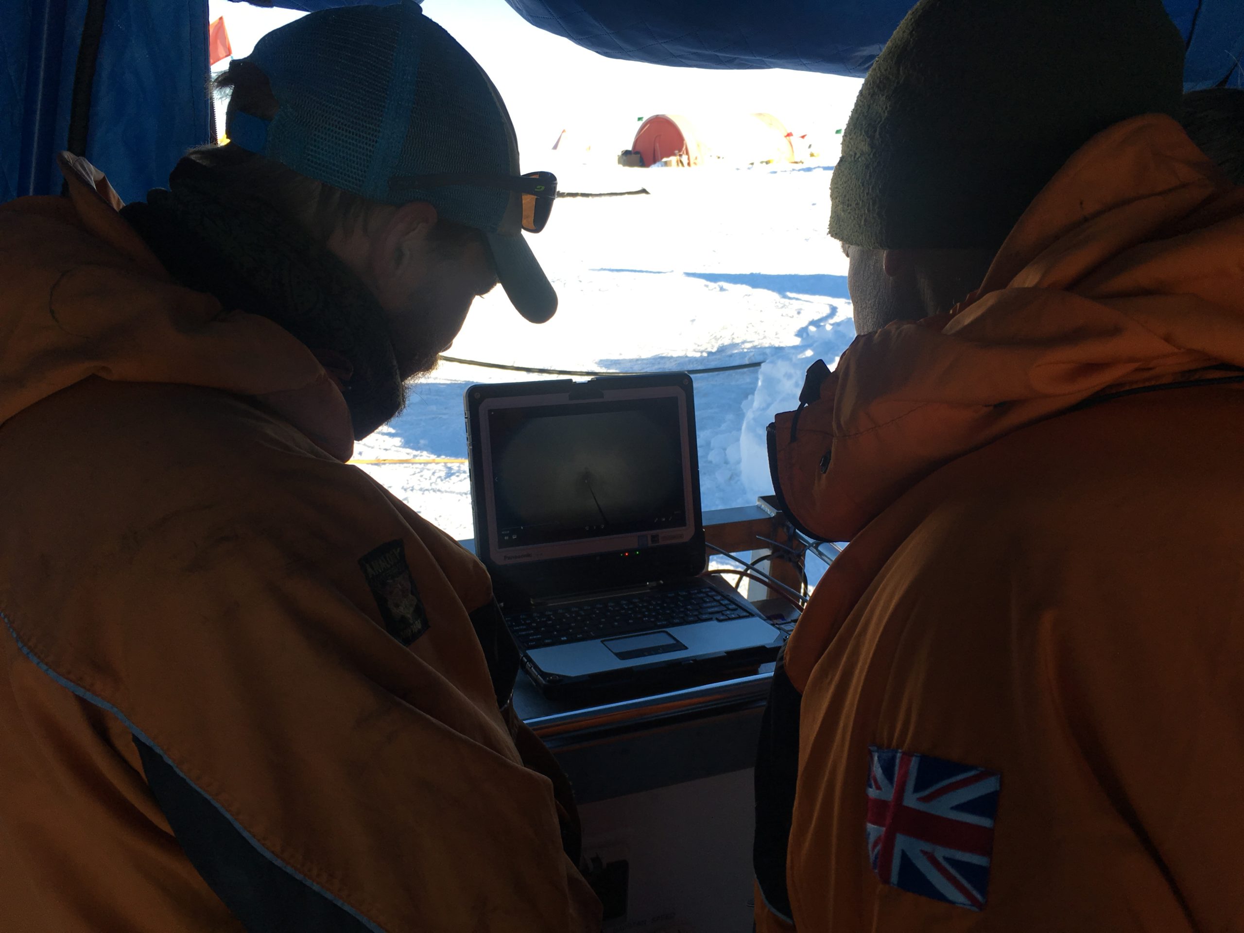
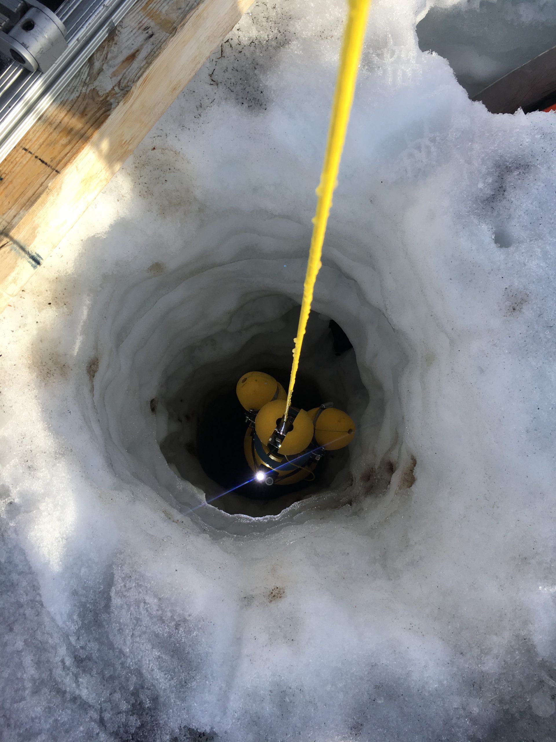
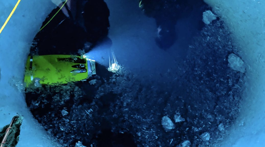
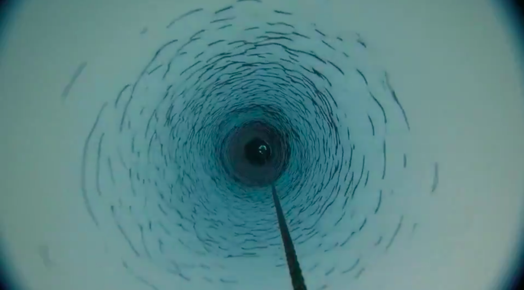
Bulletin Atomic: We’re tweeting an image from Peter Davis’ trip of the first borehole that was drilled. What are we looking at, and what does it tell your team? (Image credit: Screenshot of borehole trip video from Peter Davis, available here, as seen below)

Screenshot of borehole trip video from Peter Davis.

Dr. Schmidt: Icefin went down this 600m hole 5 times, drove about 15km total, and mapped the base of the ice, tasted the water, and measured melting — plus we found some cool organisms! When we got this video back from the Hot Water On Ice team, we knew it was safe to put Icefin and the other science instruments through the hole to start science.

Bulletin Atomic: Are there instruments left in place at Thwaites Glacier? Are you getting real-time readouts or does someone have to go back to collect the instruments and data?

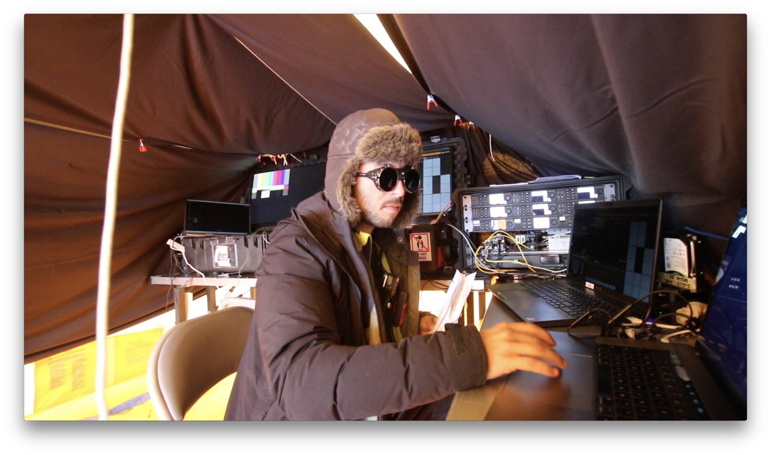
Dr. Schmidt: Lots of the teams have left instruments to measure change and monitor conditions on Thwaites Glacier over the next few years. MELT has GPS stations and tilt meters and ApRes that Hot Water On Ice and glaciologist Kiya Riverman and others will be working with, and a team will go back out to retrieve the instruments. The Icefin team is back remote-sciencing at the Georgia Tech College of Sciences and Georgia Tech School of Earth and Atmospheric Sciences, working on all the data from last year. Looking forward to getting papers out soon!

Bulletin Atomic: What will the melting of Thwaites Glacier and other parts of the Antarctic mean for sea level rise? How long will it take, and how high will it go

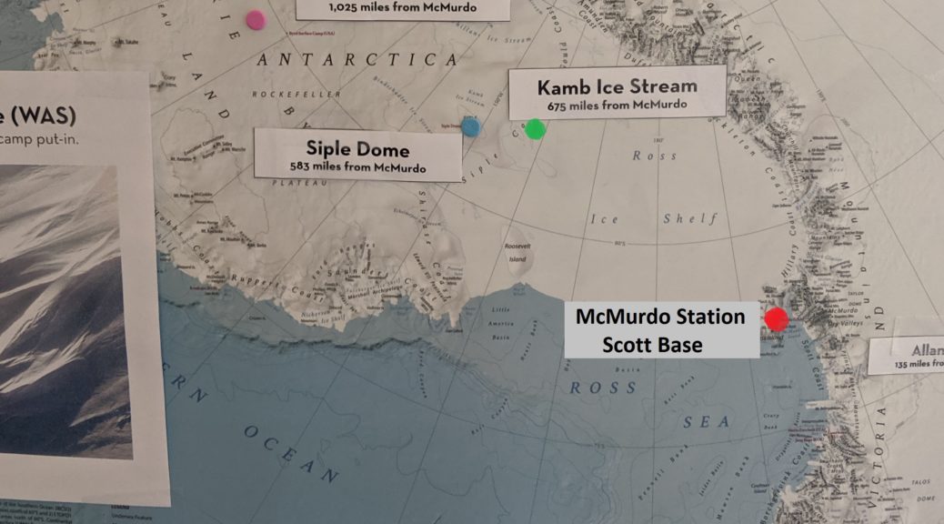
Dr. Schmidt: Thwaites Glacier is in a precarious position, like the Atlas of West Antarctica, holding back a deep basin of ice that supports the whole ice sheet. If Thwaites Glacier goes, there will be much faster loss of ice and sea level rise. We don’t know exactly how fast Thwaites Glacier is responding to climate change, which is why the National Science Foundation and Natural Environment Research Council put together the International Thwaites Glacier Collaboration, because we have to find out.

Bulletin Atomic: What stands out about working in such a remote area? As the technology improves, how will it help future researchers study the glacier?

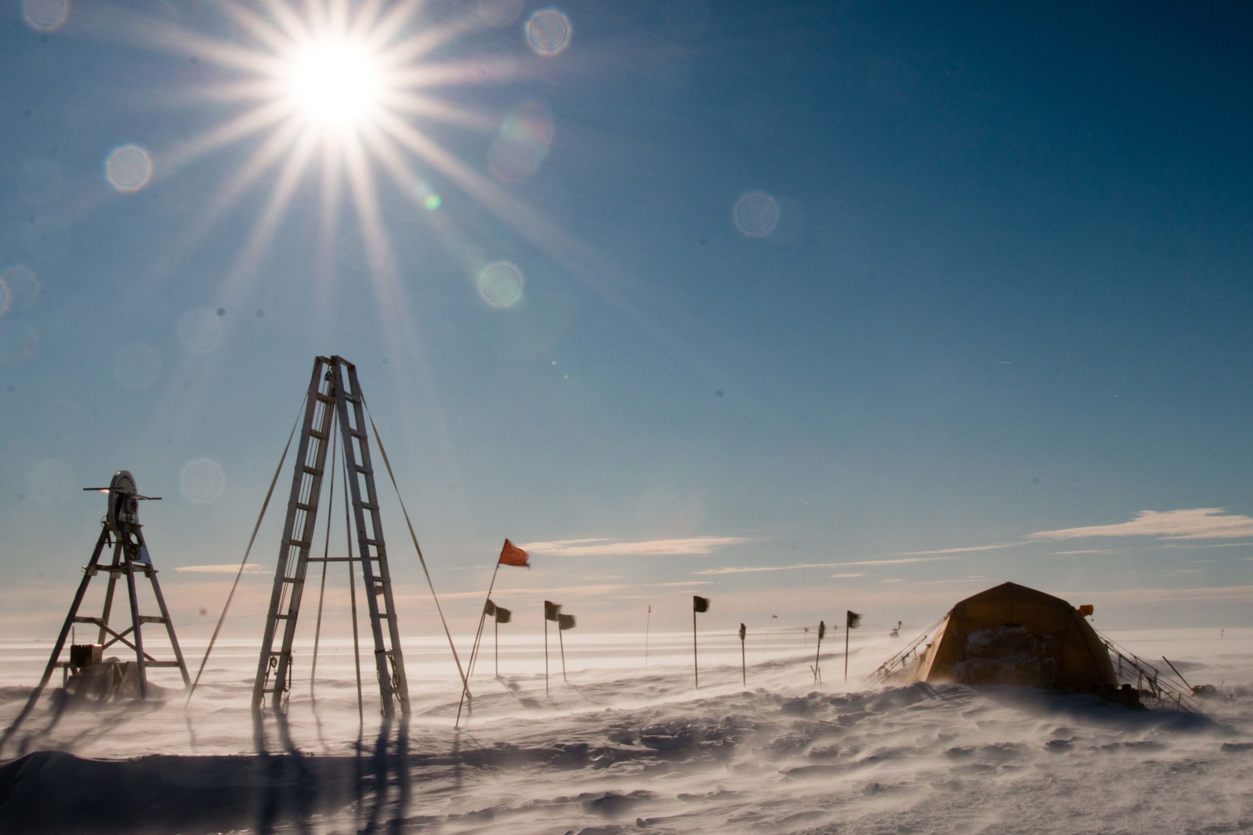
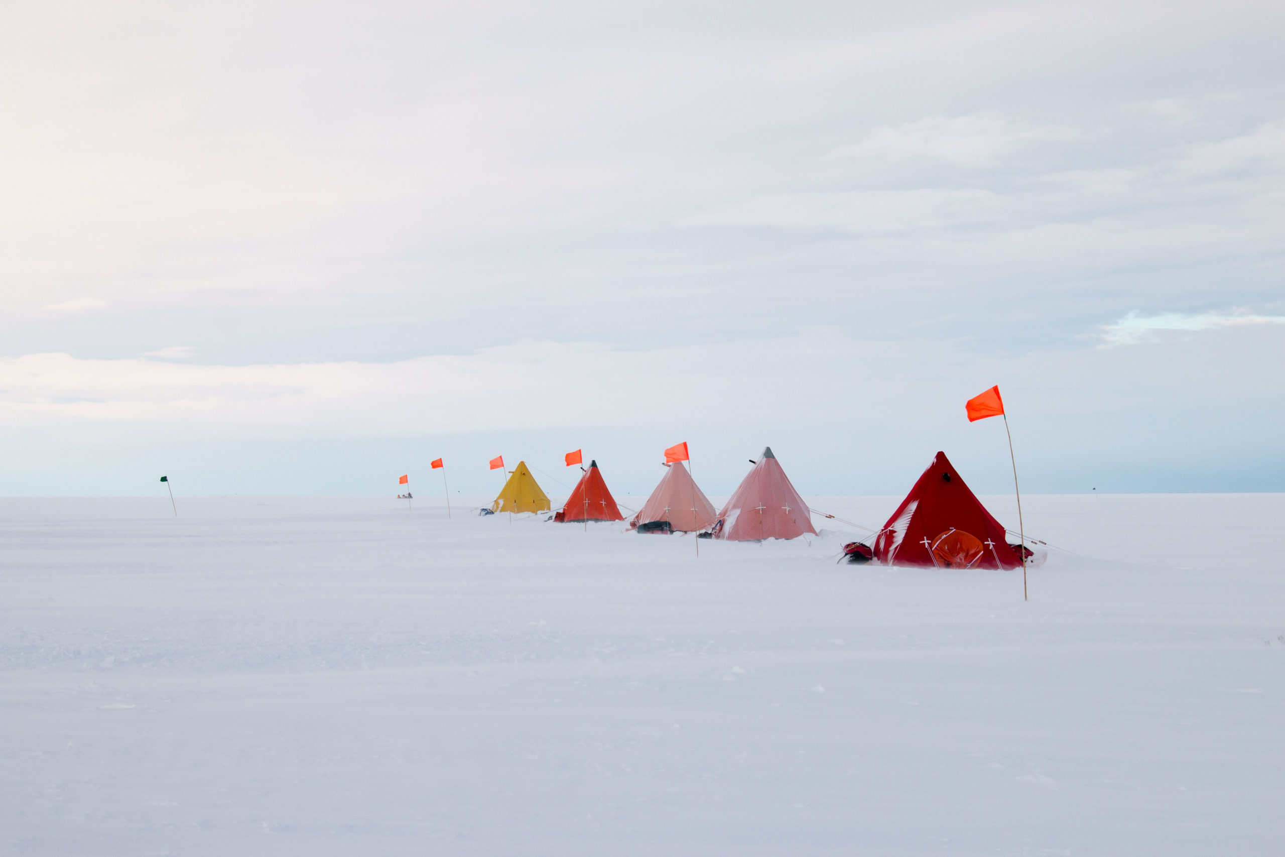
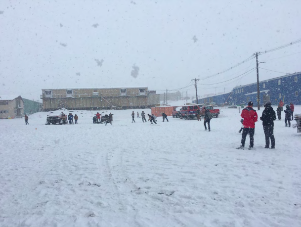
Dr. Schmidt: Working on Thwaites Glacier was incredibly humbling and exciting. Antarctica is one of the few places that just knocks you back off your feet when you see it. Technology is definitely improving, helping us see new things, but the people doing the work mean even more.  Science is a human endeavor, and a moral imperative. But sometimes you do get to drive robots under the ice, which is pretty cool.

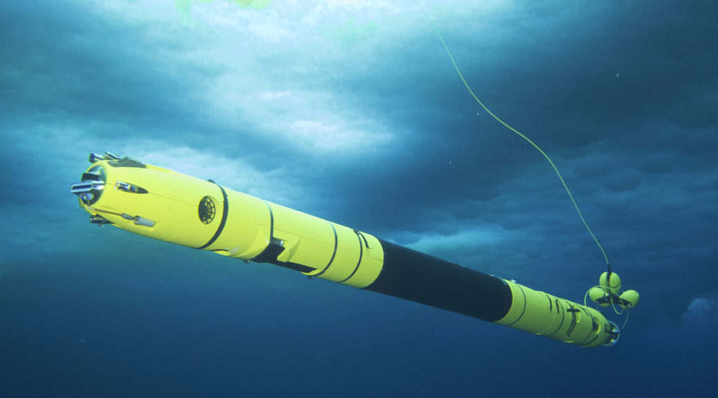
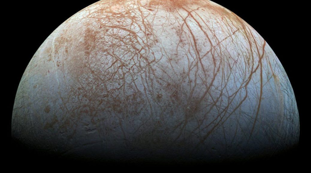
From our perspective, using technology that NASA funded us to build to one day get to Europa, has helped us see our own planet in new ways. Icefin lets us see, “taste”, and “touch” the processes as they happen, swimming the instruments right up to where the action is, which is a new way to understand the ocean and the ice. And it’s pretty cool, because we can add those measurements over a mile away from the bore hole to seismic data from Kiya Riverman and ocean and radar data from Hot Water On Ice, and we get a new picture of how melting at the ice base is happening. Then you add together the work being done by MELT to the science from THOR, TARSAN, GHOST, DOMINOS, GHC, TIME and PROPHET and the whole Thwaites Glacier team can help us really know what’s happening now and what will happen next.

Tech Spotlight: Oculus Sonar

Curious about the scientific instruments Icefin has to help it do groundbreaking (and ice-breaking!) field work? From salinity and temperature readings, to seafloor imaging and sonar mapping, Icefin has a collection of instruments that help scientists look at all kinds of things under the ice.

Here, we’ll talk about Icefin’s Oculus sonar from Blueprint Subsea, which can be spotted on the nose of the vehicle in the video below, taken during a dive under sea ice near McMurdo Station in Antarctica.

Footage of Icefin under sea ice near McMurdo Station, Antarctica during the 2019-2020 field season. You can see Icefin’s blue Oculus sonar on the nose of the vehicle. Video was filmed by the Icefin team using a Trident ROV. Big thanks to Trident developer Eric Stackpole for getting us our Trident. Icefin work was supported by USAP, NSF, and NASA.

Both Icefin vehicles have Oculus MD750d sonars, including when they were deployed during the 2019-2020 field season (in McMurdo Sound, as well as at Thwaites Glacier and Kamb Ice Stream). The Oculus sonar used by Icefin is a compact model by Blueprint Subsea, which allows the vehicle to monitor long, narrow boreholes, and navigate beneath the ice in precarious locations, all while using the sonar to map interesting features on the ice and seafloor interfaces, including fractures, rifts, melting, and grounding zone environments.

In the photo below, along with some icicles (which we call Icefin-icles, since they formed on Icefin), you can see a close-up of the Oculus sonar – it’s the blue and black oval-shaped device on the front of Icefin.

“The sonar was simple to integrate into our vehicle and gives us great situational awareness during our missions. The support from the Oculus team was also outstanding,” said Anthony Spears, Icefin Research Engineer. “The most outstanding experience we have had was when Blueprint was able to manufacture and deliver an Oculus sonar to us in the deep field in Antarctica in less than two weeks to ensure full data collection capabilities during a very important field season.”

Icefin covered with icicles as water dripped down the vehicle while being retrieved from under the Kamb Ice Stream.
The blue and black Oculus sonar from Blueprint Subsea is visible on the nose of this Icefin vehicle, which is also covered in icicles.

But before heading out to the deep field camps, the team also spent about a month in McMurdo Sound deploying Icefin through the sea ice and swimming out below McMurdo Ice Shelf from October-November 2019. It’s easier for the team to take a few weeks getting the vehicles ready for the deep field while in reach of the resources and relative comfort of McMurdo Station. Moreover, the unique ice-ocean processes and ice environments around the area are good planetary analogs. McMurdo Ice Shelf is a smaller shelf stemming from the extreme northwestern corner of Ross Ice Shelf. By drilling through the relatively thin sea ice right at the edge, the team was able to map the base of the ice shelf, without requiring the support of a large hot water drill like at Thwaites Glacier and the Kamb Ice Stream.

A test stitch of Oculus sonar data from a dive near McMurdo station shows the McMurdo Ice Shelf and rift system, which is part of the extreme northwestern corner of Ross Ice Shelf.
A test stitch of Oculus sonar data from a dive near McMurdo station shows the underside of the ice of the McMurdo Ice Shelf and rift system, which is part of the extreme northwestern corner of Ross Ice Shelf.

In the early part of the field season, the Icefin team focused on a 4 km long section of a rift in the ice shelf that is continually active, most recently beginning a calving period in 2016. This rift has been mapped using remote sensing and GPR data from surface surveys, but no ice shelf rift has ever been mapped in detail by an underwater vehicle (though there have been some under ice mapping studies with vehicles like Autosub). Rifts are long, wide active fractures in ice shelves that fill in with marine ice and refrozen melt water, creating an “ice bridge” between the two once continuous sides of the fracture that started the rift opening. Rifts can continue to open, but be stabilized by the regrowth of ice in the rift, until ultimately the rift calves large icebergs. Using the Oculus sonar, Icefin was able to map several kilometers of the underwater landscape; part of the data is shown in the picture above. This data will help the Icefin team understand how ice base topography, circulation, and melt water affect the formation of ice in the rift, and how the rift is evolving in time.

This map of the Icefin survey of the McMurdo Ice Shelf Rift shows the 4 km section mapped using Oculus sonar. Pink lines are a driving route the team took across the sea ice (3-5m thick) to their three operating sites. The jagged edge is the edge of the ice shelf (~15m thick), and three launch sites (marked 19A, 19B, and 19C) were the starting point for five missions (colored lines) under the opening rift (the gray shaded area). Image and dives compiled by Justin Lawrence.

“Forward-looking sonars are particularly valuable for understanding the scale of the environment the vehicle is operating in. With cameras we get great resolution, but range is typically limited to meters, due to how much energy lighting requires. With a sonar however, we can see tens to hundreds of meters in a wide swath. This lets us conduct mapping missions such as those under the rift. With the FLS we can see both edges of the feature and understand lengths, thickness trends, and variation in ice morphology indicative of changes in ocean properties,” said Justin Lawrence, Georgia Tech graduate student and Icefin team member.

During the 2019-2020 season, the Icefin team had equal efforts at both Thwaites Glacier and Ross Ice Shelf. In one field season, the Icefin crew had two teams, two vehicles, and two Oculus MD sonars operating at the same time, a major achievement for everyone involved! In both locations, the vehicles had to travel down narrow boreholes through about 600 meters of ice to reach the oceans below, described here. These results are currently being written up, and we’re looking forward to showing more once the papers are ready.

View of the Oculus sonar data (blue screen at left) being used by Britney Schmidt (hand) and Daniel Dichek to navigate Icefin as it approached the grounding line of Thwaites Glacier, January 2020.

The Oculus sonar equipped on both icefin vehicles provided scientists with important data that will be used to better understand the nature of the Thwaites Glacier, the Ross Ice Shelf, grounding zones, and may provide insight into what ice-covered oceans on other worlds might be like. Sonars are also key parts of the navigation for underwater vehicles, and will be important for future spacecraft missions.

“The Oculus sonar has been a great addition to the Icefin platform. Not only has it performed flawlessly in the harsh Antarctic environment, it also plays a crucial role in how we navigate the under-ice environment. With no light and very little information about our surroundings we would be lost without the MD750d,” said Matt Meister, Icefin Lead Engineer.

Icefin’s work in Antarctica was funded by both NASA as part of PSTAR project RISE UP, and by NSF as part of the International Thwaites Glacier Collaboration (ITGC). Both missions were the result of massive collaborations. The Thwaites project was a collaboration with the British Antarctic Survey and made possible by the ITGC, and included an critical contribution by the British team, who drilled the borehole. On the Ross Ice Shelf, the Icefin team worked with the Antarctica New Zealand Ross Ice Shelf Programme, which is funded by New Zealand Antarctic Research Institute (NZARI), with hot water drilling funded by the Victoria University of Wellington and managed by the VUW Antarctic Research Centre’s Science Drilling Office.

Our 2019-2020 Icefin field team during the last dive we did near McMurdo Base, before we split into two teams. Each team had a robot to conduct deep field dives, one below Thwaites Glacier and the other beneath Ross Ice Shelf.

First look under Thwaites Glacier and Kamb Ice Stream

Georgia Tech scientists get first look deep under Antarctica’s Thwaites Glacier and Kamb Ice Stream

ANTARCTICA — An international team including scientists from Georgia Tech captured new images and first-of-its-kind data from deep beneath an Antarctic glacier, which will help scientists to better understand the impact of one of Antarctica’s fastest changing regions and its impact on future sea level rise.

"It's our 'walking on the moon' moment." Thwaites Glacier Icefin quote

Their work will be featured as part of a special report on BBC World News on Tuesday, Jan. 28, in celebration of the 200th anniversary of the discovery of Antarctica.

Stationed in Antarctica for the last two months, the MELT (Melting at Thwaites grounding zone and its control on sea level) team, part of the International Thwaites Glacier Collaboration, deployed ocean instruments and cored sediments to gather data on one of the most important and hazardous glaciers in Antarctica. The MELT team included Georgia Tech scientists who used an underwater robot named Icefin to navigate the waters beneath Thwaites Glacier and collect data from the grounding zone – the area where the glacier meets the sea.

Dr. Britney Schmidt, lead scientist for Icefin and associate professor in Georgia Tech’s School of Earth and Atmospheric Sciences, said the new data represented several firsts for her team, as well as for science as a whole.

“We designed Icefin to be able to finally enable access to grounding zones of glaciers, places where observations have been nearly impossible, but where rapid change is taking place,” said Schmidt, a co-investigator on the MELT project. “We’re proud of Icefin, since it represents a new way of looking at glaciers and ice shelves. For really the first time, we can drive miles under the ice to measure and map processes we can’t otherwise reach. We’ve taken the first close-up look at a grounding zone. It’s our ‘walking on the moon’ moment.”


Located in a remote part of Antarctica, where few scientists have ever ventured, the team battled sometimes hostile weather, extreme winds, and temperatures below -22 degrees Fahrenheit to get close enough to the Antarctic coastline for Icefin to reach the grounding zone.

In these trying conditions, the MELT team used hot water to drill through up to 2,300 feet – nearly a half mile – of ice to get to the ocean and the seafloor below. On Jan. 9 and 10, Icefin swam more than a mile from the drill site to the Thwaites grounding zone, to measure, image, and map the glacier’s melting and gather other important data that scientists can use to understand the changing landscape and conditions. Not only did the team put one Icefin robot down the borehole at Thwaites Glacier, but they did it with a second Icefin vehicle in collaboration with Antarctica New Zealand near the grounding zone of Kamb Ice Stream, part of the Ross Ice Shelf.

Thwaites Glacier, which covers an area the size of Florida, is particularly susceptible to climate and ocean changes. Thwaites melting accounts for about 4 percent of global sea level rise, and the amount of ice flowing out of Thwaites and its neighbouring glaciers has nearly doubled in the past 30 years, making it one of Antarctica’s most rapidly changing regions.

"We're particularly concerned about Thwaites." Thwaites Glacier quoteDr. Keith Nicholls, an oceanographer from British Antarctic Survey and UK lead on the MELT team, said Icefin’s exploration of sediment and other conditions in the Thwaites grounding zone will help scientists determine how this region will change in the future and what kind of impact on sea level rise we can expect from these changes. The MELT team also deployed radars and oceanographic sensors, conducted seismic studies and took sediment cores from beneath the glacier, and deployed two moorings through the ice that will record ocean and ice conditions for the coming year to monitor changes at Thwaites.

“We know that warmer ocean waters are eroding many of West Antarctica’s glaciers, but we’re particularly concerned about Thwaites,” he said. “This new data will provide a new perspective of the processes taking place, so we can predict future change with more certainty”

The MELT project is funded by the International Thwaites Glacier Collaboration (ITGC), a collaboration between the U.S.’s National Science Foundation and the UK’s Natural Environment Research Council.

From left, (1) Icefin image of sediment laden ice at the grounding zone of Thwaites Glacier, Antarctica. (2) Icefin view of the grounding zone of Thwaites Glacier, Antarctica, in less than one meter of water. (3) Icefin image of sediments and rock in the ice at the grounding zone of Thwaites Glacier, Antarctica.

“To have the chance to do this at Thwaites Glacier, which is such a critical hinge point in West Antarctica, is a dream come true for me and my team. The data couldn’t be more exciting,” Schmidt said. “And exploring the grounding zones of two different glaciers in the same season is incredible.”

In addition to the MELT project, Schmidt is the Primary Investigator for the RISE UP (Ross Ice Shelf and Europa Underwater Probe) project, which also had team members from Georgia Tech deployed in Antarctica this season.  RISE UP is a NASA-funded project that developed Icefin from a prototype to a full-fledged underwater vehicle and aims to develop technology for future missions to Jupiter’s moon Europa.

Both the MELT and RISE UP teams spent time at McMurdo Station, Antarctica conducting research, before simultaneously deploying to more remote areas. Antarctic logistics for both projects were supported by the National Science Foundation, under the United States Antarctic Program.

RISE UP‘s work at Kamb Ice Stream came as part of a collaboration with two projects supported by Antarctica New Zealand: the NZARI Ross Ice Shelf Programme led by Dr Christina Hulbe of the University of Otago, and the NZ Antarctic Science Platform’s Antarctic Ice Dynamics project, led by Dr Huw Horgan of Victoria University. 

RISE UP team members deployed along with the New Zealand hot water drilling and science teams to study the Kamb Ice Stream – a river of ice – on the Ross Ice Shelf in Antarctica. Their goal was to explore and map areas near the grounding zone to better understand its flow and the surrounding environment.  Icefin’s work at Kamb Ice Stream will continue next season as part of Dr. Horgan’s project.

“We now have, effectively, a transect of conditions from the front of the Ross Ice Shelf to the grounding line,” sadi Christina Hulbe of the Ross Ice Shelf Programme, which finished its final year of field work in late December. “In addition to Icefin’s work, we’ve installed our third ice-anchored mooring, collected cores for sedimentary and microbiological analysis, we’ve imaged the ice optically and using radar, and made high resolution observations of ocean conditions.”

The RISE UP team completed three dives with Icefin, and team member Ben Hurwitz, a graduate student at Georgia Tech who works on Icefin’s technology, said the season was wildly successful, adding the team was “excited to share what we found in the coming months.”

Notes on the projects:

The International Thwaites Glacier Collaboration: www.thwaitesglacier.org

The MELT Project is lead by Keith Nicholls , an oceanographer with the British Antarctic Survey (BAS), and Dr. David Holland, an applied mathematician (with a background in fluid dynamics) at New York University, with co-leads Dr. Eric Rignot from the University of California at Irving, Dr. John Paden with George Mason University, Dr. Sridhar Anandakrishnan out of Pennsylvania State University, and Dr. Britney Schmidt at the Georgia Institute of Technology.

RISE UP’s field work at Kamb Ice Stream came as part of two science projects funded by Antarctica New Zealand and the Victoria University of Wellington Science Drilling Office. The other research partners involved on the project are: The University of Otago, Victoria University, University of Canterbury and University of Waikato, NIWA and GNS Science from NZ and the ROSETTA project and Universty of California, Santa Cruz in the US.

Week 8-10 Update: Icefin Team 2019 Antarctic Field Season

Well, folks, that time we’ve been waiting for is upon us: the Icefin teams are about to attempt dives at the grounding zones of the Kamb Ice Stream and Thwaites Glacier!

Figure 1: Andy, Britney and the Kamb Team wait for the transport van in explorer pose.

Figure 2: Andy helps the Kamb Team load their gear.

RISE UP at Kamb Ice Stream Camp with ANZ

In exciting news, all members of the Icefin KAMB team are now on site at the edge of the Ross Ice Shelf, and are as we type working towards Icefin’s first dive through the grounding zone. Matt, Justin, Ben, Peter, and Enrica have been busy preparing Icefin and helping with general duties at the Antarctica New Zealand field camp. Hot water drilling at the site began this week and science is underway! Keep your eyes on @the_Ross_Ice_Shelf_Programme on Instagram for more updates! When we’re able to get a few updates and maybe an image or two we will also update you on Icefin’s social media.

Figure 3: The team was thrilled when Matt departed, the first Icefin team member to move out to a deep field camp.

Figure 4: We’re finally on the transport list to Thwaites!!

Icefin team headed out to Thwaites Glacier

The International Thwaites Glacier Collaboration program has been waiting for a break in the weather at WAIS divide camp to get to move folks out to camp. In a week of emotional highs and lows, the weather finally broke in our favor and the first flights to get ITGC personnel into WAIS divide camp and on to their field sites happened late Wednesday, with MELT’s own James Wake, along with USAP safety lead Loomy, and GHC member/radar guru Seth Campbell made it out! The team of three made it to the grounding zone down stream (GZDS) Site where the first hot water hole will be drilled. The safety team was able to land at the site and successfully establish camp. Since then, the intrepid pilots of the Twin Otter and Basler aircraft, both USAP flown by Kenn Borek Air out of Canada and the British Antarctic Survey TO, have completed many rotations to start bringing gear out to the camp. The Basler being able to land at both Cavity Camp (where colleagues in TARSAN will be working) and at GZDS has meant that much faster gear delivery has been possible, making up time from the early season weather delay.

Later in the week the second wave of the team, consisting of the British Antarctic Survey drill and science team, made it on a flight out of McMurdo to WAIS, where Paul Anker and James Smith went to the LTG field camp to break all out all of the drill equipment which was staged over winter to be sent to GZDS. The remaining team, PI Keith Nicholls, mountaineer Catrin Thomas, and Pete Davis proceeded on to the camp site at GZDS where they are establishing camp and receiving gear. The Icefin portion of the MELT team, Twin Otter and Basler aircraft, both USAP flown by Kenn Borek Air out of Canada and the British Antarctic Survey TO, have completed many rotations to start bringing gear out to the camp. The Basler being able to land at both Cavity Camp (where colleagues in TARSAN will be working) and at GZDS has meant that much faster gear delivery has been possible, making up time from the early season weather delay. Later in the week the second wave of the team, consisting of the British Antarctic Survey drill and science team, made it on a flight out of McMurdo to WAIS, where Paul Anker and James Smith went to the LTG field camp to break all out all of the drill equipment which was staged over winter to be sent to GZDS. The remaining team, PI Keith Nicholls, mountaineer Catrin Thomas, and Pete Davis proceeded on to the camp site at GZDS where they are establishing camp and receiving gear. The Icefin portion of the MELT team, consisting of Britney, Dan, and Andy are currently all packed up and eagerly waiting their flight to WAIS Divide, which is waiting on good weather to leave MCM. They’ll be joined by PI David Holland and Aurora Basinski-Ferris, as well as members of the TARSAN team. In addition to all the oceanographers, the team was also joined by the final MELT field team members lead by Kiya Riverman, who will be a few days behind the Icefin and NYU teams.

Figure 5: David Vaughn gave a truly inspiring Sunday night science lecture about the Thwaites program and its role in predicting and mediating sea level rise.

Hurry Up and Thwaites

During the weather delays, the Icefin team has kept as busy as possible. It’s rare to get a few weeks to catch up, particularly from generally exasperated PI Britney. We’ve used the extra time to make progress in several important areas. Britney has finalized her chapter for the upcoming Planetary Astrobiology book (University of Arizona Press) and been trying to help lead Editor Vikki Meadows as much as possible. She also submitted a Nature Geoscience paper with the Dawn team, and sent back revisions on two planetary science papers by current and former students that should be soon submitted. LPSC abstracts have also been edited for the grad and undergrad students in Atlanta. Now she’s trying to finish proofs on the chapter and this weekly-ish update!! Andy has been working hard to bring the in situ microscope designed for Icefin closer to being ready or field operations, and has made great progress with the extra time. Dan has been working on the redesign of Icefin’s power system and collecting various media to pass on to the BBC and NOVA crews working with the MELT team. Dan is looking forward to helping be team cameraman along with David and Aurora while we’re out at Thwaites. And while we would all have rather been out in the field, having the chance to go to the Helo Hanger concert was a social highlight of the season. McMurdo is an incredibly artistic and talented community, and getting to see several of our friends and colleagues play life music is always a treat, and ran the gamut from folk music to indie rock to a Green Day cover band.

Figure 6: Dan cleans the sea water tank in the Crary Lab as the Icefin team prepares to deploy to Thwaites. Lots of gear return and space cleaning happened this week!

Figure 7: Gemma from BBC films Icefin being driven up to Science Cargo.

While at McMurdo the MELT portion of the Icefin team had the opportunity to work with a film crew representing BBC News and BBC Frozen Planet II. Britney gave an interview describing Icefin and its role on the ITGC initiative, as well as insight into how she became a planetary and earth scientist. The BBC team then filmed Britney, Dan, and Andy preparing the vehicle to be sent to the deep field. The three person BBC team and ITGC lead David Vaughn of BAS have been fun additions to the crew, bringing a different perspective on the potential reach of these critical activities. We’re honored to be a part of it!

Figure 8: Justin, Gemma and Ben from BBC with Icefin in the Icefin Crary Lab “studio.”

Figure 9: Some of the weather contributing to our delays was rather wonderful! Huge fluffy snow came down over three days, culminating in a massive snowball “fight” on Sunday. Mostly we just ran around and tossed snow in the air.

This update would be remiss without mentioning the absolutely herculean efforts of several parts of the community over the past few weeks.

First and foremost, the WAIS Divide and LTG camp staff have been real heroes, working with a fraction of the people they had planned to get the camp up and running, establishing runways and weather reports, and supporting the flotilla of small aircraft who have been keeping the Thwaites dream alive! Cargo movements and camp activities have been underway despite the weather and small crew, the camp mechanics have done a fabulous job getting the traverse equipment up and running, and the carp team now has the camp ready for full time science support. They’ve been doing all of this in heaps of Condition 1 weather, i.e. REALLY HORRIBLY AWFUL. We owe these guys a ton!

Figure 10: Another time-honored tradition in McMurdo: trying, and failing, to prevent getting the crud. Britney looks forward to one day being reunited with her real voice.

Figure 11: Crevasse rescue training with Catrin, MELT team mountaineer.

Next up: the KBA and BAS pilots. These teams fly into challenging places and make great things happen. Their efforts to get the landing sites surveyed for safe landings, and taking care of all of our cargo and passengers is absolutely critical.

Figure 12: Andy practices crevasse descent.

Figure 13: Ready to get out to Thwaites!!!

Finally: the implementer team, lead by Leslie Blank and Nick Gillett. Every time there is a delay, it changes the plans downstream, and this team has been doing an amazing job of staying on their toes, and keeping things moving forward. It’s easy to feel trapped and get down when these delays occur, but the implementer team has been doing a remarkable job of juggling unknown weather and excitable science teams. So that’s it for now! 

Michelle Babcock from the GT Icefin team will be sending out some blurbs from us while we’re out in the field. Enrica and crew will pick up the bulky emails and photos when they return from Kamb, currently sometime just before or after the new year. Brit, Dan and Andy will be out in the field until probably middle to late February, so look for our next check in around Feb 1. Happy holidays to you all out there, and thanks so much for everything you do to support us, from watching cats to sending treats, to fixing machinery, and everything in between!

This year the field team for Icefin consists of:
Britney Schmidt, Matt Meister, Dan Dichek, Anthony Spears, Justin Lawrence, Ben Hurwitz, Andy Mullen, Peter Washam, and Enrica Quartini.

RISE UPhttps://live-schmidt-astro-cornell.pantheonsite.io/project-rise-up/
MELThttps://live-schmidt-astro-cornell.pantheonsite.io/thwaites-melt/
ITGChttps://thwaitesglacier.org
RISPhttps://www.instagram.com/the_ross_ice_shelf_programme/

For more updates, pictures, and videos, find us on Facebook, Instagram, and Twitter @icefinrobot

Week 5-7 Update: Icefin Team 2019 Antarctic Field Season

Sorry for the long delay between updates, friends! The Icefin team has been busy at work the past few weeks with both dive operations and deep field preparations, all culminating with a lovely Thanksgiving holiday. We’ve finally found the time to dig out the pen and ink (or computer, I suppose).

Figure 1: Icefin under the ice, photographed by USAP Diver Rob Robbins who was diving nearby.

On November 14, we were joined by the rest of the C-444 Thwaites-Melt team, including Keith Nicholls, Peter Davis, James Smith, Paul Anker, Catrin Thomas and James Wake from the British Antarctic Survey and David Holland and Aurora Basinski-Ferrisof NYU.

Figure 2: The Icefin and Melt teams took a moment for a group photo on the ice.

Figure 3: Still from an Icefin dive under the rift, showing the approximate vehicle position under the rift. The screen segments show vehicle attitude and depth on the left and snapshots of live data values we use to QC the data.

Among the highlights since our last update were our final four science dives in the McMurdo area. The team deployed Icefin at two additional sites along the roughly East-West running ice shelf rift that has been our primary science target of our operations out of McMurdo. This allowed us to map the structure of the underside of the rift along over a good segment of its length. As far as we know, this is possibly the first detailed and the most comprehensive underwater study of an ice shelf rift.

Figure 4: Forward looking sonar profiles of the narrow end and broad end of the rift, looking up.

Rift formation is an important part of ice shelf evolution that contributes both to stabilizing the ice and to calving, depending on the setting and ocean conditions. With Icefin and its suite of oceanographic, biological, and perception sensors, we have surveyed the structure of the rift, ocean conditions underneath it to assess marine ice healing of the rift, as well as parameters that describe the water column conditions that affect ecosystems under the ice. We conducted three survey missions, including at two new sites, 19C and 19A, that allowed us to start at the narrow end of the rift where it begins as a crack to places where it splits into two systems, with segments as wide as 40m. Hopefully when combined with satellite remote sensing, we will have an excellent data set for comparison.

Figure 5: Data from dive 9 showing the ice surface (gray), ice base (black) and vehicle position (colored for depth). Each of the data streams can be plotted in a similar fashion to construct 3D data sets.

To some people, all ice looks the same, but to ice nerds like our team (ok, maybe mostly to the PI and science team), all of the varying ice structures and conditions beneath the rift are fascinating. The draft (depth) of the ice varies by up to 10m below the rift, with everything from semi-regular conical platelet lumps on either side to down-dropped blocks covered in platelets but with preserved angular features. We could watch (and have watched) the videos for hours. 

Figure 6: Bathymetric sonar data from Icefin’s new Norbit sonar, processed using the Qimera software package. During this part of the dive, we swam close to the edge of Observation Hill as it meets the seafloor.

During our last dive, we deployed ICE03 at the Jetty (fish hut 19) and put together a basic mission to map sections of the bathymetry offshore McMurdo at great resolution with our new Norbit bathymetric sonar (another first for the team!) in preparation for our work to come out at Thwaites glacier. Excitingly, we also got to use this dive as an opportunity to train the rest of the MELT team on Icefin operations. The BAS and NYU teams got a chance to participate in deploying the vehicle, to see Icefin in action, and recover the vehicle. We also took a few great team photos.

Figure 7: Montage of the BAS-USAP Deep Field Shakedown. Top: Dan and Andy get schooled on the Primus lamp by BAS mountaineer James Wake, and Britney and Dan hang out in the Scott Tent, which will be what the team lives in during the Thwaites season. Bottom: James demonstrates the Tilly lamp operation as Keith, Pete, David and Aurora look on.

It’s also been a time of training for our team, in preparation for the deep field. The part of the team going to Kamb Ice Stream (KIS) camp received a half-day Antarctic field training from Antarctic New Zealand while the MELT part of the team had an overnight training on the sea ice led by British Antarctic Survey mountaineers. The Kamb team had a dry run of camp arrangements and plans way back in October before deploying to the ice, but got to work with the ANZ crew on safety procedures for the camp. Because national programs have their own protocols for safety and operations, getting to participate in safety training prior to working together allows for a common language in the field.

Figure 8: Tent city out on the ice shelf (left) and the late-night view through the clouds back towards the instructor hut and Mt. Discovery.

The full Melt team completed our deep-field shakedown, where we had the opportunity to camp out for a night on the ice shelf as a team using the equipment we’ll be using out in the deep field. For the Icefin team, this was our first chance to experience the famous “man food” boxes that BAS is contributing to the project. We were introduced to Biscuits Brown and a surprising variety of dehy meals. The best part was definitely working with the classic Primus stoves and Tilly lamps. We’ve since had a course on their upkeep and repair as well, and are feeling ready for the field, whenever that should happen!

Figure 9: Packed house for the Wednesday night MELT lecture.

Figure 10: Seal in the dive hole while Icefin patiently waits to confirm heading solution.

On Nov 20, David Holland organized the Melt team to give the Wednesday night lecture as a team to describe how the whole filed program will work, and the scientific motivation behind it. David, James Wake, Paul, Britney, Pete Davis, James Smith, Aurora, and Keith all gave short presentations about the field campaign, drill, and science plans. Britney introduced the Icefin team and described the plans for Icefin working at the grounding zone. The Crary Library was packed with folks curious about this large piece of the International Thwaites Glacier Collaboration.

Figure 11: Thwaites crew plus Enrica enter the final boxes into cargo, and begin the wait to fly out.

Prior to the talk, part of the team also got to go over and visit Scott Base for dinner to catch up with our colleagues Greg Leonard and Maren Richter. Next year, we’ll be deploying Icefin along with these folks under Inga Smith’s Marsden project through the University of Otago. Following that work on the sea ice, we’ll be hoping to also join for a second season out at Kamb.

Figure 12: Paul Cutler introduces Britney and Icefin to the crowded galley for the Sunday night public lecture.

On Nov 24 Britney gave the Sunday night science lecture to a packed audience in the galley, who stuck around the talk for at Q&A session and swarmed in to take a look at Icefin’s science and navigation modules, which the team brought to the galley. It’s always one of the highlights of the season to get to share our work with and thank the community that works so hard to support the work we do. We showed videos of the missions under the rift as well as highlights from last season, and stuck around for an hour afterwards answering questions and hanging out with the robot.

Figure 13: Icefin pops through the platelet ice, viewed by our OpenROV Trident.

The final push over the past two weeks has been to finish the season and get the two teams packed up for the deep field. As of today, both Icefins are packed and the team is patiently waiting for the weather to cooperate and allow flight opportunities to KIS camp and Thwaites camp. The weather has so far kept both teams in town, a full week of delays thus far for the Kamb team and ANZ drillers due to weather on the Siple coast. Thwaites operations have also slowed due to weather, but the site safety team (John “Loomy” Loomis, Seth Campbell, and James Wake) going in to prove the camp site is ready to fly on the next flight out. The positive note has been that we all got to spend Thanksgiving celebrations in McMurdo, have a delicious meal all together, and enjoy calling home for the holidays. The team participated in the Turkey Trot 5k, shared the Thanksgiving tradition with our British colleagues for their first Thanksgivings, and had the chance to spend more time together as a full team in advance of what will hopefully be the move out to Kamb this week for the ICE02 team.

Figure 14: We’ve been treated to some rare and beautiful snow days in McMurdo lately. This shot is from our dorm 207, back towards the Galley (blue), Southern, Crary lab, and Observation Hill in the background. Atop Ob Hill is across left by the returning party in honor of Robert Falcon Scott and his team that made it to the south pole, only to die in tragedy 12 miles from their food depot. The team heard two fantastic lectures by Artist & Writers program participant Sarah Airriess who is writing and illustrating a graphic novel about the expedition.

This year the field team for Icefin consists of:
Britney Schmidt, Matt Meister, Dan Dichek, Anthony Spears, Justin Lawrence, Ben Hurwitz, Andy Mullen, Peter Washam, and Enrica Quartini.

RISE UPhttps://live-schmidt-astro-cornell.pantheonsite.io/project-rise-up/
MELThttps://live-schmidt-astro-cornell.pantheonsite.io/thwaites-melt/
ITGChttps://thwaitesglacier.org
RISPhttps://www.instagram.com/the_ross_ice_shelf_programme/

For more updates, pictures, and videos, find us on Facebook, Instagram, and Twitter @icefinrobot


On the eve of deployment

(Note: This post was written before a week-long delay due to weather and before Matt, our lead engineer, managed to make it out, but most of it still holds.)

I’m anxious.

Not nervous. Anxious.

Our bags are packed. The vehicle and it’s associated spares, tools, and other miscellany have been boxed and are sitting in the airfield waiting to be loaded into a Basler tomorrow for our deep field deployment to the Kamb Ice Stream.

The anxiety comes from the waiting.

Three years of waiting for this to happen.

The deep field.

Maybe that should read “The Deep Field”.

It feels like something that’s so far away, both spatially and temporally. But within twelve hours, we’ll be heading there to do something that nobody has ever done before.

Three years of preparing.

More for Britney. I can’t imagine her anxiety levels. And she won’t even be there when the vehicle accomplishes its mission, its purpose, for the first time.

(Don’t worry, we’ll take pictures.)

660 meters of ice. That’s 2165 feet. Half a mile. With a 14″ wide hole down, down, down to the bottom. To the underside of the Ross Ice Shelf.

The Ross!

The largest ice shelf in the world. (By area only, as Peter keeps saying; by volume, the Filchner-Ronne is larger).

And we’re going to the bottom.

The anxiety is real.

Does that come across in this blog? Are you anxious with me?

I’ve never been to The Deep Field before. I hope I packed right. Mostly that’s base layers, socks, and a toothbrush.

A month in the middle of nowhere.

Never before will I have been so far from, well, anything.

KIS-1 (“Kamb ice stream 1”), also called HWD-1 (“Hot water drill 1”), is located at 82.77S, 156.57E. The nearest anything is Simple Dome camp, at 81.65417S, 149.005E. And that’s a field camp, not exactly a bustling place. But that would be the closest actual place, 105 miles approximately north.

Select deep-field deployment locations for USAP and ANZ
The Ross Ice Shelf and surrounding region with select USAP and ANZ deep field sites marked. McMurdo and Scott Base locations are marked separately.

That’s an 11 minute flight, for those counting at home, according to WolframAlpha. Or 760 microseconds, if you’re a photon.

Looking at it from that perspective, it’s possible I’ve been farther from people before.

But I don’t think that it’ll feel that way once we’re there.

Due to some unforeseen circumstances (the C-17 delays and the weather at other sites delaying flights), we’ve gotten lucky. We’ll be flying out a touch earlier than expected, and we’ll be flying with the drillers. So we’ll be among the first out there. This is extremely valuable; the Thwaites project has been massively behind due to the same flight delays, and thus all flights from McMurdo have been pointed towards their staging ground at WAIS Divide (79.4675 S, 112.0864 E). Thus we need to get a flight to KIS-1 before the Thwaites flights start taking people. Because then we become a much lower priority for USAP. Which is fair; Thwaites is a $25 million project, whereas KIS-1 is not even a US-sponsored field camp.

The Basler we’ll be flying is a modified DC-3. A DC-3! The plane was around prior to WWII! The Baslers, though, have excellent records in Antarctica. They have upgraded avionics and engines, modified fuselage and wings, and a host of other new features. Which is reassuring. I was a little perturbed when I was told it was a DC-3.

By the time you read this, we’re likely to already be in camp, setting up tents, building snow walls to ward off the wind, and checking out the vehicle. I’ve been told that The Deep Field focuses you. You’re forced to have singular purpose. Distractions are removed from sight and mind.

But man, am I anxious.


Project RISE UP Could Help Scientists Explore Europa’s Ice-Covered Ocean

Based in McMurdo Station, Antarctica for the first part of their 2019 field season, the team on Project RISE UP is using its underwater oceanographer robot Icefin to study environmental and biological factors that influence habitability in oceans beneath ice.

Project RISE UP, an acronym which stands for “Ross Ice Shelf and Europa Underwater Probe”, is using Icefin to explore ice-ocean environments and the limits of life here on Earth, in order to help develop techniques that might be used for future exploration of ice-ocean ecosystems.

NASA confirmed in 2019 that Europa, one of Jupiter’s moons, had plumes of water vapor above its surface, which scientists had long expected from the ice-covered world. In addition, using observations from ground-based telescopes, “scientists have found strong evidence that beneath the ice crust is an ocean of liquid water or slushy ice,” according to NASA. These and other factors make Europa a prime subject in the search for other habitable worlds in our solar system.

Georgia Tech graduate student and member of the RISE UP team in Antarctica, Justin Lawrence‘s thesis is a major driver of work being done in the 2019 field season. He said the science and technology being developed through RISE UP could be used in the future exploration of icy worlds in our solar system, such as Europa.

“For my thesis, I’m mapping biological water mass properties including cellular abundance and microbial diversity with physical water properties such as temperature, salinity, and dissolved oxygen,” Lawrence said. “When combined, these variables help us understand how nutrient and carbon inputs from the open ocean and melting ice influence habitability below ice.”

In other words, studying biological and environmental factors that influence life in ice-ocean ecosystems here on Earth, will help scientists understand habitability in ice-covered oceans elsewhere.

“Earth is not the only body in our solar system with a liquid, salty ocean, and other ocean worlds such as Jupiter’s moon Europa might prove habitable to novel forms of life,” Lawrence explained. “To better understand how ecosystems under ice could work on other planets, we are developing hardware (Icefin), software, and scientific methods to first understand the interactions between life and ice in Antarctica.”


The diagram depicts the unique circulation patterns that result from atmospheric cooling of the surface ocean, sea ice formation, ocean currents, and ice shelf melting to distribute nutrients below Ross Ice Shelf
The diagram above depicts the unique circulation patterns that result from atmospheric cooling of the surface ocean, sea ice formation, ocean currents, and ice shelf melting to distribute nutrients below Ross Ice Shelf. The Ross Ice Shelf, located in Antarctica, is a floating mass of ice the size of Spain, which gets up to nearly 1 kilometer thick.

In addition to research being conducted at McMurdo Station in the 2019 field season, RISE UP will also fly with Icefin to the Ross Ice Shelf grounding zone, in collaboration with New Zealand’s Ross Ice Shelf Programme, where they will deploy Icefin along with other oceanographic sensors through a 35 cm wide, 700 m deep hole in the ice to explore the ocean below (as shown in the diagram above).

Week 4 Update: Icefin Team 2019 Antarctic Field Season

Happy November!!  We’ve just completed one month on ice, officially week four of operations.  C444/B041 has been up and running with science dives at last! To be clear—we use every dive to improve our understanding of the environment under the ice, but our “science” dives are those that occur at a site of interest with a fully functional and checked out vehicle, prioritizing science as the main driver for the mission.  Especially because we are preparing for deep field missions supporting NASA, NSF, BAS/NERC and ANZ science, we also are conducting operational tests and field team training during each of these dives. All in all, we are meeting our science, operations, engineering, and training goals.

Figure 1: Icefin team dive documentation.

We keep a careful record of our process each dive through a system of checklists, check ins and check outs, and documentation. The Icefin team begins each dive by filling out a dive card that logs important information about the mission plan, instrumentation and vehicle status, location, and roles of the team.  Dive notes are also taken both on the dive log through the topside computer for elements of the dive such as science readings, vehicle status, image annotation, etc, and by hand to record key events for later perusal and post dive meetings. Cards and notes are all kept by participants and a copy is archived for future reference.

Figure 2: Iced-fin after a dive. The vehicle doesn’t ice up, but the water dripping off at the surface will occasionally make fun Icefincicles.

We conducted three science dives on Tuesday 11/5, Thursday 11/7, and Saturday 11/9 of last week.  During the first dive, we tested our drop weight solution as well as vehicle mobility after a a vehicle “cast” to the sea floor (what we refer to a straight downward or upward mission element through the water column to gather oceanography data to reference to our RBR CTD).  We will be diving in areas where sediment cores will be taken, so we have been tuning our ability to translate away from the borehole to release the drop weight in an area that won’t disrupt the coring. We also worked in all three dives on tuning our vehicle magnetic and inertial navigation solutions to guarantee we have a streamlined manner of referencing position and heading under the ice.  Finally, we continue to be able to retrieve the vehicle through 35 cm drill holes without the assistance of thrusters, which is needed for the deep field. The new aft “backup cam” has proven most useful for understanding vehicle state, especially during deployment and retrieval. 

For all three dives, we have been operating out of fish hut 01, just adjacent to the ice shelf and about 500m North of the East-West-running rift in the ice shelf.  Here, we are able to study several elements. Rift formation and evolution has been studied via remote sensing, seismic and GPR studies, but not much from below. Icefin allows us to map the structure of the bottom of the rift to get at these questions.  Simultaneously, we can map the water column under deep ice, which has different oceanographic conditions and history from that under the sea ice. Right at the rift, there also may be two unique inputs to the water column: brine rejection from marine ice formation inside the opening rift, and surface melt water connecting down through the cracks in the ice.  The combined mechanical and oceanographic questions about rift evolution are relevant topics for both Earth and Planetary Science, trying to understand how ice shells of all varieties operate and impact the oceans below. 

Figure 3: Partial Icefin tracks from Dives 5 & 6 plotted on top of our planning map. We’ve been operating at Site B and will be moving to Site C next week.

On Tuesday, we completed season dive 4, ICE03 dive 11.  The mission included the drop weight and heading tests, followed by a 500m drive out to the rift, then profiled across the 40m wide feature with the sonar and upward camera, and proceeded about 50m past the rift.  There we descended to 50m depth below the shelf and back up to create a cast of the upper water column. We continued on from there, crossing the rift and ice shelf again, and then decided to poke around back up the rift this time very close to the ice to view with cameras as well as get the CT and DO sensors right into the boundary layer under the platelets.  All in all, we spent 5.5 hours under water.

Figure 4: Fiber team foreman Andy Mullen monitors the tether down to Icefin during a dive.

On Thursday, we completed dive 5, which was a missing involving underwater heading tests followed by a long drive along the rift. We were also working on the use of waypoint following, tuning Icefin’s ability to autonomously hold position and travel along paths and between waypoints, which was a good test of the vehicle navigation.  The mission included a 150 m cast, followed by a 500m drive to the rift, after which we drove along the rift pitched up slightly to keep the rift structure in the forward-looking sonar (Oculus). We followed the rift for over 1000m, completed a cast to 50m, and then viewed the ice. We were also joined via helicopter by the CEO of ANZ, Sarah Williamson and an ANZ team.  They timed arrival perfectly, so we had the great opportunity to show them Icefin operations and live feed from the rift. We successfully recovered the vehicle after ~6 hours of operation.  

Figure 5: Boop! A visitor in mission control. 
Figure 5: Boop! A visitor in mission control.

On Saturday, we completed dive #6, which was a resounding success.  We’ve been proud of our ability to quickly scale up from vehicle commissioning activities to testing and operations and finally science, but our real mark of success is a “perfect dive” where all parts of the operation from packing to retrieving the vehicle go smoothly.  No dive is ever perfect really, there are always challenges during the dives, but the team’s ability to anticipate and adjust to the circumstances is key to ideal operations, and as of Dive 6 the Thwaites team who have been primarily operating ICE03 are in good spirits looking towards the deep field.  Of course, the highlight was the science. After completing a set of tests of the heading above the ice, we deployed the vehicle for a 150m cast and a brief heading and tuning check. We then drove back out to the starting point of Dive 5, and this time turned East and traversed the rift over 1000m to the East of the starting point.  The vehicle and team operated smoothly for the whole dive, communicating back and forth from mission control inside the hut to the tether team outside. At the end of the long survey, we completed a cast down to 130m, during which we profiled from the supercooled layer down through the ice shelf water, and encountering what we joked was a “shrimp-ocline” from 80 to 110 meters, in a region we’ve not usually seen so much activity.  After completing the cast, we surveyed the rift up close, and then retrieved the vehicle after ~5 hours under water.  

Figure 6: Left: Icefin Dive 6 vehicle position (colored line, colorized by depth) showing the 150m cast at the beginning of the dive (at plot origin, left corner), traverse out to and along the rift (ice base black, interpolated ice surface gray), and 120m cast at the far edge of the rift. Right: Raw (uncorrected) temperature and salinity values during the dive, colorized by depth for referencing to position.

Figure 7: Peter, Andy and Enrica complete a heading & mag “spin test” before deploying the vehicle.

Figure 8: View of the vehicle position, heading and snapshots of critical data streams from the base station computer (left screen) and sonar image of the rift (right screen). The rift is the long linear lines, where the brightness is increased reflection off the sides of the rift and the rough ice in the middle is fractured and rifted shelf ice filled in with marine ice and platelets.

 All in all, the last week was a huge success.  During the week, we’ve completed over 3000m of surveys of the rift and shelf, collected multiple CTD casts and water samples to complement the vehicle sensors.  We’ve collected over 16 hours of under ice data. The plan for the next week is to repeat similar science dives and tests with the ICE02 vehicle that’s heading to Kamb Ice Stream with ANZ.  We’ll be moving into true mobile operations, working out of a tent at Site C for two of the dives, and then keeping an eye on completing our missions the following week at Site A. We’ll also be joined by our BAS and US colleagues from the Thwaites Melt project, and starting to pack up for the two deep field campaigns.  Have a lovely week out there!

Figure 9: Sara Williamson and team tour mission control.

Figure 10: A local visitor (a penguin) departs camp.
Figure 10: A local visitor departs camp.


This year the field team for Icefin consists of:
Britney Schmidt, Matt Meister, Dan Dichek, Anthony Spears, Justin Lawrence, Ben Hurwitz, Andy Mullen, Peter Washam, and Enrica Quartini.

RISE UP: https://live-schmidt-astro-cornell.pantheonsite.io/project-rise-up/
MELT: https://live-schmidt-astro-cornell.pantheonsite.io/thwaites-melt/
ITGC: https://thwaitesglacier.org
RISP: https://www.instagram.com/the_ross_ice_shelf_programme/

For more updates, pictures, and videos, find us on Facebook, Instagram, and Twitter @icefinrobot

Week 3 Update: Icefin Team 2019 Antarctic Field Season

Greetings all! Week three was packed with excitement for the Icefin team (C444/B041). Most excitingly, we officially became a two-robot field team, with both Icefins successfully completing dives. The week began with the Icefin base camp set up, situated on the sea ice ~ 8 km out across from McMurdo near where the sea ice meets the McMurdo Ice shelf, the “ice-shelf transition,” followed by performing two vehicle dives and collecting CTD data and water samples, and ended with the team enjoying costumes and music at the McMurdo Halloween party!

Figure 1: The Galley helped us all get in the spirit of Halloween.

On Tuesday, part of the team went out to assist McMurdo Fleet Ops as they installed our fish hut and drilled the fish hut dive hole. The team rolled up their sleeves and shoveled plated ice relentlessly as waves of ice and water flooded the sea ice surface when the drill reached the ocean. It was quite an epic experience for the new members of our team who had never experienced the raw power of the Reedrill or set up fish hut ops before. Meanwhile, the rest of the team stayed at the lab to ballast and trim our second vehicle, ICE02, in the aquarium tank, repeating the procedure used for ICE03.

Figure 2: Britney and Ben assemble Icefin under the LARS.

On Wednesday we proceeded to our second dive of the season, with the goal to finalize the ICE02 ballast and trim at the Jetty Fish Hut (FH19), which once again went really smoothly. This time, the B041 team manned the controls on Icefin. During the dive, so much progress was made that we were also able to execute several “plus up” goals for the dive, engineering system tests that included magnetic heading and controls tests. We also had the chance to set up and inspect our Launch and Recovery System (LARS). To cap off the day, on Wednesday night, Peter gave a science talk at the Crary Library titled: “Switching Poles: Atmosphere-Ice-Ocean Interactions beneath one of Greenland’s last remaining ice shelves”. He had a full audience and did a fantastic job of describing his past work on Petermann Gletscher.

Figure 3: First CTD data of the season.

Friday we took ICE03 on its second dive (third of the season), this time using a LARS deployment. To complete the dive, the team used the newly installed the LARS outside of FH19, where Mission Control operated. The dive was a great success, which was constructed from 5 elements: heading tests above and below the water, 100 m and 500 m tracks out under the ice both to calibrate the current profiler (ADCP) and test data collection for the new bathymetric sonar (the Norbit), and waypoint following and station keeping tests, as well as vehicle retrieval tests. We gathered some very helpful data on the vehicle systems as well, and identified some refinements to improve control. All in all, the dive was a win, especially with the great views of the brinicles coming through the sea ice, and visit from a suspicious mammal.

Figure 4: Dan drives ICE03 under the sea ice. At left are the feeds from the four cameras on the robot (fore top & bottom, aft, and up/down HD), and on the right screen are the driving controls, a heading dial, depth, pitch and altitude values, the map view of the mission (center of the screen), and switches for vehicle systems during the dive.

Figure 5: Spying Weddell seal. No, we totally don’t see you there, bro.

Figure 6: The team lifts Icefin on the LARS for the first time this season. 
Figure 6: The team lifts Icefin on the LARS for the first time this season.

One of the big changes for the team this year has been the use of a customized jiffy drill attachment to bore a 14” hole in the ice, the same size as the dive holes we expect to use at the grounding zones of Kamb and Thwaites Ice Stream. It’s not a casual or comforting experience dangling your research program through a small hole in the ice. Luckily, the team has worked hard to try to design the best possible approach to the problem, which is what allows Icefin to complete its unique tasks at locations far from the edge of the ice. Icefin is ~9.5 inches (24cm) wide, so the 14” (~35cm) hole is a good model for the deep field. Moving to the drill attachment has also let us reduce the amount of fuel and time that it takes to prep for deployment, replacing a melting process using the “hotsy” with the new drill attachment. We completed several tests, adjusting the position of the vehicle “bridle” that helps right it under the water so that it is retrieved smoothly through the narrow hole. We conducted three “dead robot” tests, where we stop the robot in a difficult position under the ice away from the retrieval hole, and then “play dead” while the team retrieves it using only the tether. All tests were successful, which was exciting news for the team! We’ll continue to test and certify the solution over the next few weeks. We finished the week off by prepping the vehicle and gear for the move to operations out at our main Icefin site this coming week. Stay tuned!

Figure 7: View of a brinicle and platelet ice growing underneath the sea ice from the ICE03 forward camera.


This year the field team for Icefin consists of:
Britney Schmidt, Matt Meister, Dan Dichek, Anthony Spears, Justin Lawrence, Ben Hurwitz, Andy Mullen, Peter Washam, and Enrica Quartini.

RISE UP: https://live-schmidt-astro-cornell.pantheonsite.io/project-rise-up/
MELT: https://live-schmidt-astro-cornell.pantheonsite.io/thwaites-melt/
ITGC: https://thwaitesglacier.org
RISP: https://www.instagram.com/the_ross_ice_shelf_programme/

For more updates, pictures, and videos, find us on Facebook, Instagram, and Twitter @icefinrobot

Week 1 and 2 Update: Icefin Team 2019 Antarctic Field Season

Welcome to the Icefin Field Season 2019-2020!  We’ve got an ambitious season ahead, involving two related Icefin projects: a continuation of the work from last season for B-041-NASA funded RISE UP project (PI Schmidt) in collaboration with Antarctica New Zealand’s Ross Ice Shelf Programme & Antarctic Ice Dynamics programs (Pis Hulbe & Horgan), and C-444 International Thwaites Glacier Collaboration Thwaites-Melt project (ITGC MELT, PIs Nicholls & Holland), funded through a collaboration between the UK NERC and the US NSF.  We’re thrilled to be down here with two Icefin vehicles this year, prepping for dual grounding zone deployments in the December-January time frame at Kamb Ice Stream (B041) and Thwaites Glacier (C444).  We’ll be updating you regularly on our progress from the field, at least as long as our access to emails allows!

Week 1 & 2: Oct 10 – Oct 27 2019

After much travelling and a few delays, the Icefin team is almost completely reunited down in McMurdo! Our first scouting team
composed of Ben Hurwitz, Andy Mullen, and Enrica Quartini arrived in McMurdo on Thursday 10/10, followed by Dan Dichek, Justin Lawrence, Britney Schmidt, and Peter Washam on 10/12, and finally Anthony Spears, following a rare boomerang flight on 10/20.

Figure 1: Members of the team en-route to McMurdo on a C17.

Figure 2: Planned deployment sites (red site markers) approximately 7 km due south of McMurdo Base at the sea ice-ice shelf transition zone; science targets (square markers).

The first week was busy with training, team planning meetings, and sorting out equipment, including receiving a sleek new set of sturdy,
custom-made wooden boxes that were built for us by the Carp Shop over the winter to carry ICE03 modules to the sea ice — they’ll make a great second set next to the ICE02 ones! Our allocated Pisten Bully has been loaded with survival bags and drilling and rigging equipment and we also staged equipment on our sleds and more
equipment at the ice transition, ready to go. As of early last week, FS&T finished flagging a safe sea ice route to our main operations site (see Fig. 2) for the early season and the Fish Hut (our base of operations out on the ice — basically a rectangular wooden trailer-sized structure on skis with a hole in the bottom to access the ice and ocean — is out at the site and will be set with its dive hole tomorrow. We should have great pictures from that!

Figure 3: Peter Washam and Dan Dichek light a field stove in our Antarctic Field Safety Training.

Figure 4: “Stump-fin” ready for ballasting.

We’ve had some challenges with cargo. However, the Science Cargo team worked hard to address those, and luckily ICE03 traveled with the team (we continue to support Delta with our checked bag fees —33 this year!) on 10/10 and has since been successfully brought up and tested. We’ve completed a hybrid approach to ballasting the vehicle in the Crary lab test tank since we didn’t yet have our launch and recovery system (Fig. 4). Basically, Icefin is too long to fit in the 10’ tank here in the Crary lab. So, we created “stump-fin” by using a thruster module from ICE02 (which is shorter than the main electronics) and then added weight to it to match the displacement in water of the electronics.

This allowed us to do some first-order trimming of the vehicle prior to any dives to reduce the amount of work needed to get it floating properly. And sure enough, post-tank ballasting the vehicle trim was dead on and we were able to easily tweak it during our first dive and the Dive Jetty on Thursday (Fig. 5). The team worked extremely well and we were able to safely operate ICE03, conduct a series of engineering tests, and even get some footage of a fun encounter with a jelly fish along the way (Fig. 7)!

So really things are ramping up quickly and we are on a good and fast trajectory to becoming operational! The rest of our cargo arrived last week in time for the ANZ traverse to the Kamb Ice Stream camp. We’ve had meetings and contact with all of the work centers here at MCM that help our group: Mechanical Equipment Center (MEC), Field Safety & Training (FST), Berg Field Center (BFC, or basically the REI of MCM), Science Cargo, Fixed Wing (aircraft that will be flying us out to the field), and of course the Crary lab who always do such a great job helping out the science crew. We’ve had our first CTD cast and sampling run as well, so science is up and going!

Some other fun things have been going on as well. We played together as a trivia team last week (we didn’t win…go figure that a bunch of robot aficionados wouldn’t do all that well on the pop culture segments). We’ve attended science lectures on Seals and Penguins and Sea Spiders. Andy gave a fantastic science lecture to a full audience last Wednesday called “Adventures with Underwater Microscopes from the Tropics to the Poles.” Peter will be giving one this week on his Greenland work. Later in the season, we’ll give the main Sunday science lecture. We were honored to be picked as the featured science group in the station meeting last week, presented to the contractors and work centers by Dr. Karla Heidelberg, the main NSF representative on station.

Figure 5. Ben Hurwitz, Andy Mullen and Justin Lawrence move small weights in Icefin’s nose to trim the vehicle.

Figure 6. Galley pizza delivery is an important element of a long night in the field. Thanks to the Galley for making out night delicious, & Peter & Ben for delivery!

Last Monday night, the team enjoyed participating in a conference call with the International Space Station. Almost everyone on station gathered in the Galley to have a chance to see the Earth from space in real time as astronaut Dr. Jessica Meir, a former student with the penguin biology group B-197 here on station, gave us a tour of the ISS and shared some of the views from the ISS glass dome. This week, we’re looking forward to getting ICE02 in the water and starting science operations!

Picture of a hole in ice, with dark ocean beneath the ice. In the water, the yellow Icefin Robot shines light on a small jellyfish near the robot.
Figure 7. Jelly fish encounter at the Dive Jetty fish hut.


This year the field team for Icefin consists of:
Britney Schmidt, Matt Meister, Dan Dichek, Anthony Spears, Justin Lawrence, Ben Hurwitz, Andy Mullen, Peter Washam, and Enrica Quartini.

RISE UP: https://live-schmidt-astro-cornell.pantheonsite.io/project-rise-up/
MELT: https://live-schmidt-astro-cornell.pantheonsite.io/thwaites-melt/
ITGC: https://thwaitesglacier.org
RISP: https://www.instagram.com/the_ross_ice_shelf_programme/

For more updates, pictures, and videos, find us on Facebook, Instagram, and Twitter @icefinrobot