All posts by Ben Hurwitz

On the eve of deployment

(Note: This post was written before a week-long delay due to weather and before Matt, our lead engineer, managed to make it out, but most of it still holds.)

I’m anxious.

Not nervous. Anxious.

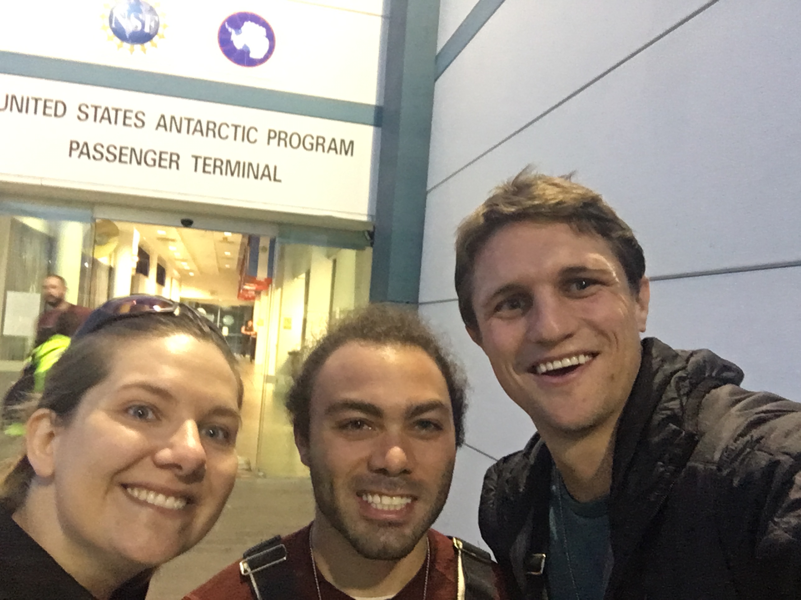
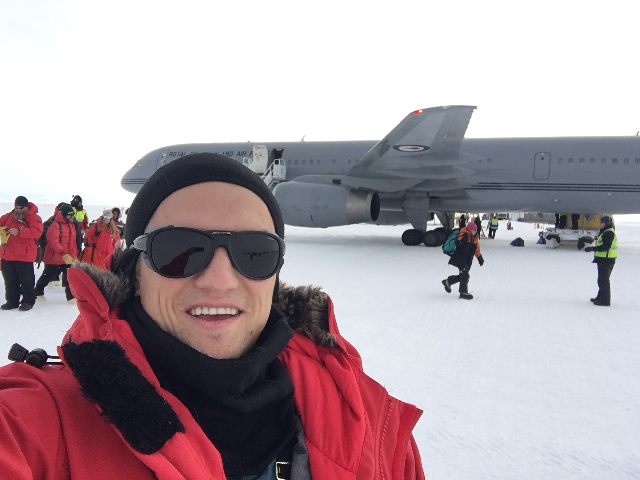
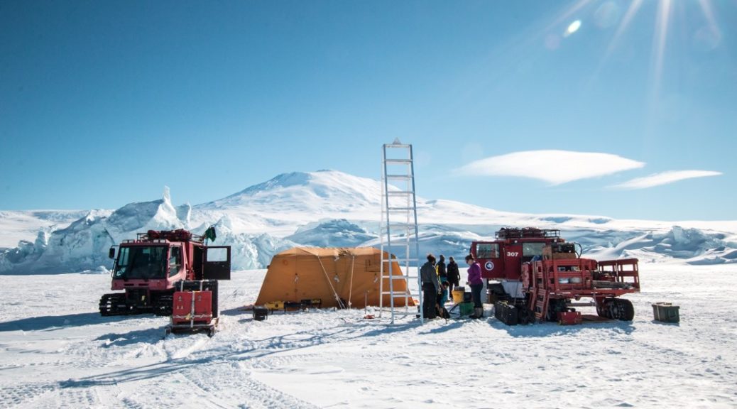
Our bags are packed. The vehicle and it’s associated spares, tools, and other miscellany have been boxed and are sitting in the airfield waiting to be loaded into a Basler tomorrow for our deep field deployment to the Kamb Ice Stream.

The anxiety comes from the waiting.

Three years of waiting for this to happen.

The deep field.

Maybe that should read “The Deep Field”.

It feels like something that’s so far away, both spatially and temporally. But within twelve hours, we’ll be heading there to do something that nobody has ever done before.

Three years of preparing.

More for Britney. I can’t imagine her anxiety levels. And she won’t even be there when the vehicle accomplishes its mission, its purpose, for the first time.

(Don’t worry, we’ll take pictures.)

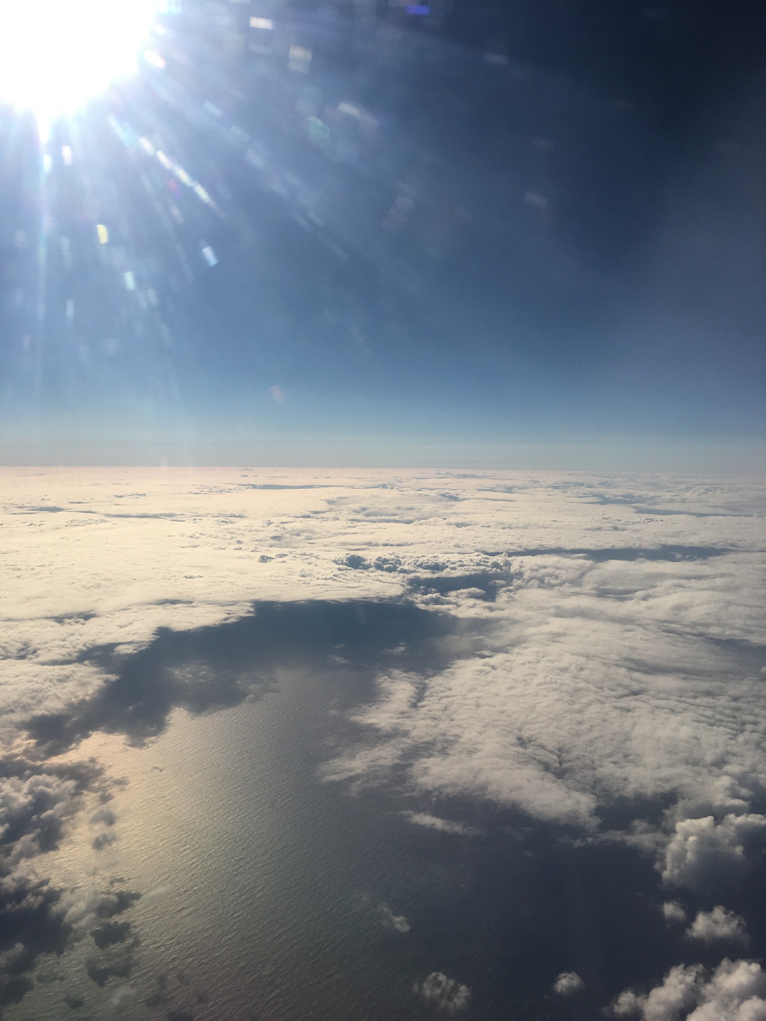
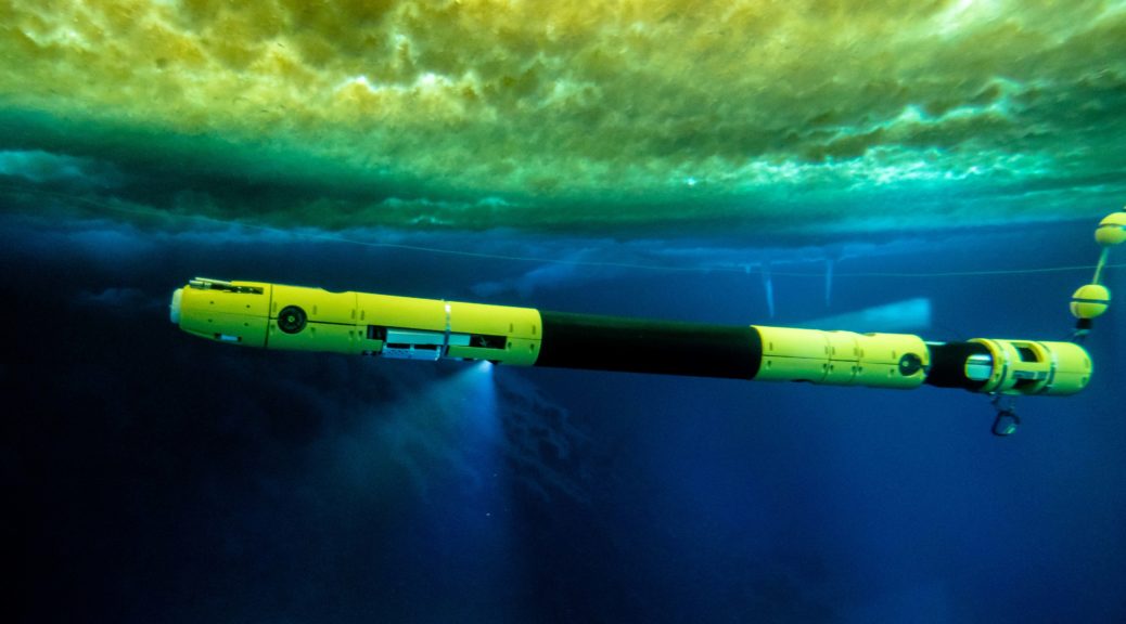
660 meters of ice. That’s 2165 feet. Half a mile. With a 14″ wide hole down, down, down to the bottom. To the underside of the Ross Ice Shelf.

The Ross!

The largest ice shelf in the world. (By area only, as Peter keeps saying; by volume, the Filchner-Ronne is larger).

And we’re going to the bottom.

The anxiety is real.

Does that come across in this blog? Are you anxious with me?

I’ve never been to The Deep Field before. I hope I packed right. Mostly that’s base layers, socks, and a toothbrush.

A month in the middle of nowhere.

Never before will I have been so far from, well, anything.

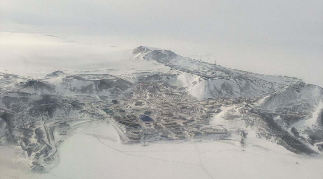
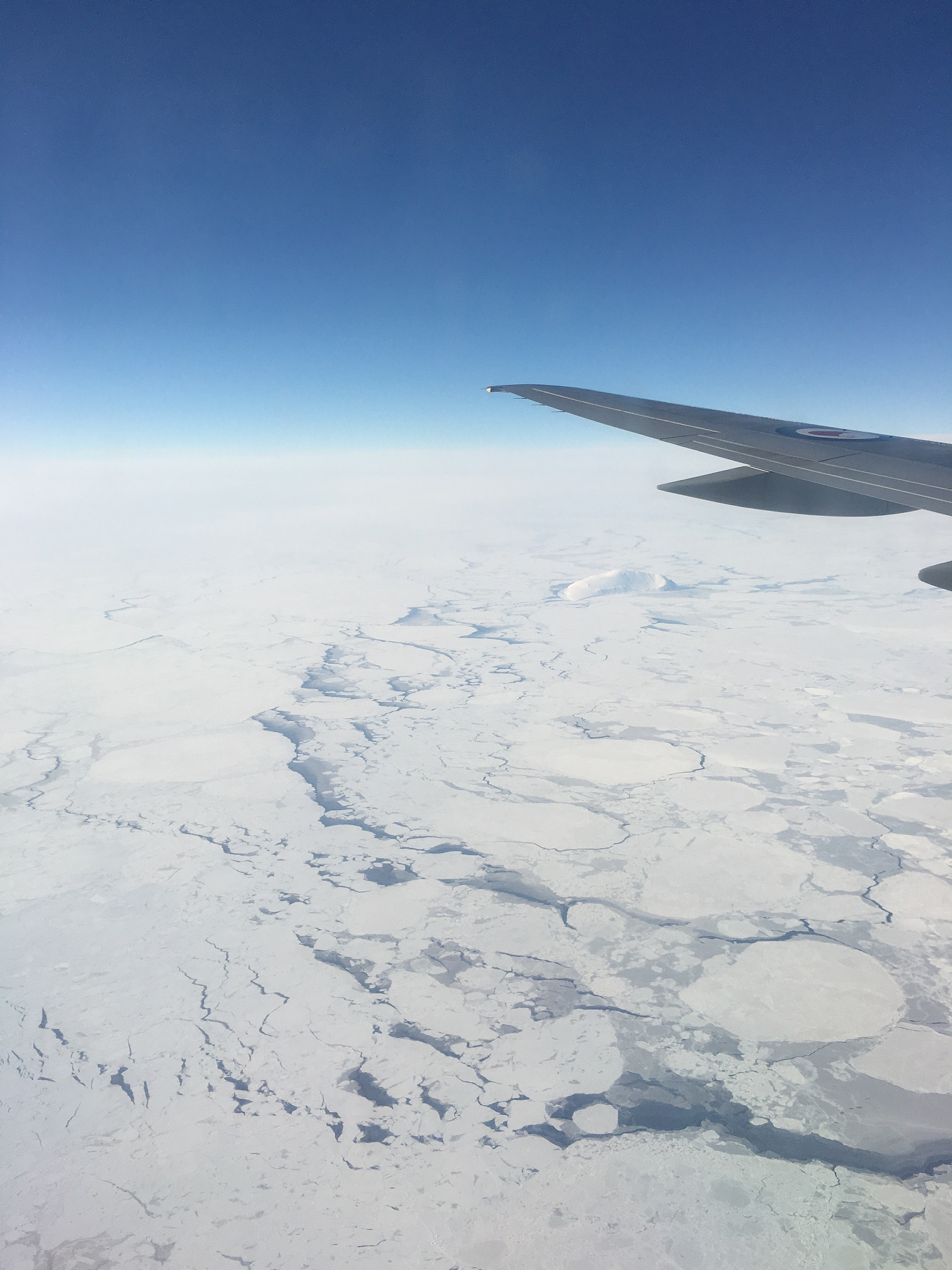
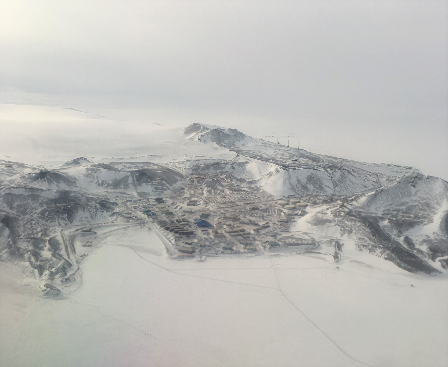
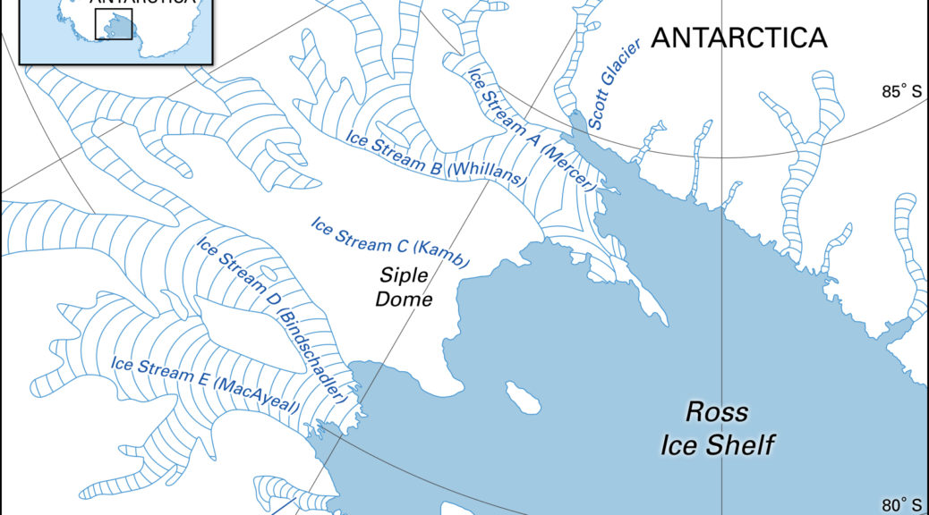
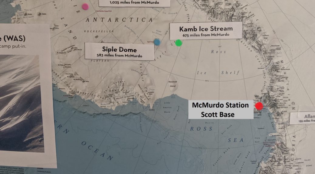
KIS-1 (“Kamb ice stream 1”), also called HWD-1 (“Hot water drill 1”), is located at 82.77S, 156.57E. The nearest anything is Simple Dome camp, at 81.65417S, 149.005E. And that’s a field camp, not exactly a bustling place. But that would be the closest actual place, 105 miles approximately north.

Select deep-field deployment locations for USAP and ANZ
The Ross Ice Shelf and surrounding region with select USAP and ANZ deep field sites marked. McMurdo and Scott Base locations are marked separately.

That’s an 11 minute flight, for those counting at home, according to WolframAlpha. Or 760 microseconds, if you’re a photon.

Looking at it from that perspective, it’s possible I’ve been farther from people before.

But I don’t think that it’ll feel that way once we’re there.

Due to some unforeseen circumstances (the C-17 delays and the weather at other sites delaying flights), we’ve gotten lucky. We’ll be flying out a touch earlier than expected, and we’ll be flying with the drillers. So we’ll be among the first out there. This is extremely valuable; the Thwaites project has been massively behind due to the same flight delays, and thus all flights from McMurdo have been pointed towards their staging ground at WAIS Divide (79.4675 S, 112.0864 E). Thus we need to get a flight to KIS-1 before the Thwaites flights start taking people. Because then we become a much lower priority for USAP. Which is fair; Thwaites is a $25 million project, whereas KIS-1 is not even a US-sponsored field camp.

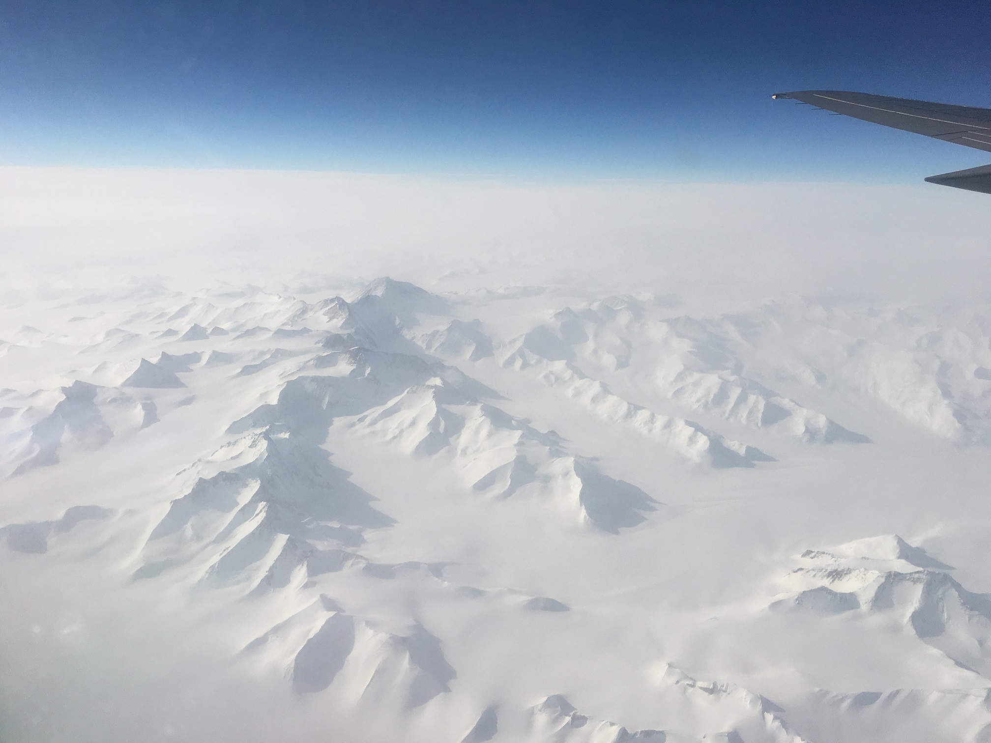
The Basler we’ll be flying is a modified DC-3. A DC-3! The plane was around prior to WWII! The Baslers, though, have excellent records in Antarctica. They have upgraded avionics and engines, modified fuselage and wings, and a host of other new features. Which is reassuring. I was a little perturbed when I was told it was a DC-3.

By the time you read this, we’re likely to already be in camp, setting up tents, building snow walls to ward off the wind, and checking out the vehicle. I’ve been told that The Deep Field focuses you. You’re forced to have singular purpose. Distractions are removed from sight and mind.

But man, am I anxious.


Flight of the 757

When I flew to the Ice in ’17, we flew to 3791 km in the classic style: a military C-17, flown by the New York Air National Guard EDIT: US Air Force (The NY-ANG flies the LC-130s), loaded to the gills with people and gear from Christchurch (CHC) in about five hours. These are the early-season workhorses of the CHC-MCM (McMurdo) flight, shuttling over the Southern Ocean multiple times a week for three months. The best part about the flight was when the pilots let people come up in twos to the cockpit and look out over the ice. It was, in a word, incredible, especially since the only other windows were a few small portholes.

It was tragic when, a few days later, I went looking in my phone for them photos only to discover they were complete missing, never to be found.

This time, the trip was more complicated. With two projects (the familiar B-041 from the past two years, and a new C-444 for the Thwaites project) with two funding sources (NASA and NSF, respectively), and a wedding (congrats to Matt and Amy!), we ended up with a number of different flights into Christchurch. Some of us got a few hours in Melbourne to kill, in which we sampled the fabulous coffee culture and the pretty great street art.

Turns out, CHC also has some pretty mean street art.

Enrica (our new field manager), myself, and Andy were designated as the “Scouts”, acting as the advance team to settle in, setup labs, shake hands, and hunt down all our stuff, so we took the first flight, on the 9th.

And this flight, it turns out, was the once-a-season Boeing 757 trip.

Run by the Royal New Zealand Air Force, the flight is on a standard passenger jet, complete with beverage carts, real seats, and (*gasp*) windows! It’s not often you get an opportunity to watch your approach into MCM, coming in over the edge of the East Antarctic ice sheet, looking out over the ice floes and mountains, the Dry Valleys, and the finally seeing Mt. Erebus loom in the distance, flying by Arrival Heights and right off the station itself before looping wide and landing on the ice. It made the C-17 seem pedestrian, and was, in a word, incredible.

It was tragic when, a few days later, I went looking in my phone for them photos only to discover they were complete missing, never to be found.

Yes, for the second time, none of my photos came out. I got a window seat and everything! I’m still bitter, ten days later.

Ah well. I’m here, aren’t I? Safe and sound.

(Above gallery photos were all taken by Andy Mullen.)

In the last photo above, you can see:

  • Hut Point (peninsula on the left),
  • where the Ice Pier will go for the boat dock in February (bay of ice on the left)
  • our dorms (four container-shaped buildings to the right of the bay of ice that are “stacked” like stairs),
  • the galley (blue building the the middle),
  • Crary labs (the weirdly-shaped building slightly forward and right of the blue building) (our lab is in the lowest and right-most part of Crary – hi!),
  • Observation Hill [Ob Hill] (peak on the right),
  • Scott base (the NZ base, right above/behind Ob Hill on the edge of the island),
  • the windmills (towards the back on the right, look like three sticks)
  • Happy Camper area (beyond the windmills, where we do our overnight trainings with USAP)
  • Mt. Erebus (not shown, but off to the left)

It’s now been nearly two weeks on Ice for us, and much has been accomplished. There have been some shipping glitches, but these are getting resolved as we move into field mode here. The Thwaites vehicle (creatively named ICE03) was checked through the CHC from ATL on Delta (an advantage of Icefin is that it’s commercially fly-able anywhere in the world), and then flew on our Ice flight, so we got that up and running again in a few days upon arrival with only minor hiccups. Around this bring-up, we’ve been going through the requisite trainings and briefings that are standard upon arrival here, waiting for the go-ahead to get out on the sea ice.

Speaking of sea ice, it’s a very dynamic year in the McMurdo Sound. There were a few big winter storms (apparently it was an interesting winter) that blew out a lot of the young sea ice as it was forming, and there was less snow cover to protect the young ice. Due to these and other factors, the sea ice is quite thin this year – up until this week, it was only averaging around 110 cm (this past week was cold and clear, which allowed it to thicken to 130 cm). While it is thicker than a lot of Arctic sea ice and can hold up thousands of pounds without difficulty, it is still much thinner than usual – typically, the ice is 3-4 meters thick at this time! This makes it easier for us to deploy, since we have to drill through less, but it also means the sea ice season will be shorter, which makes the shipping concerns even more concerning.

To further increase the pressure, there were two delays to the flight schedule this season already, once in Winfly (the first post-winter passenger flight, taken in mid-August) due to weather, and then once this past week. The more recent one was especially unfortunate for us – the C-17’s windshield cracked during approach, causing it to boomerang (i.e. return to CHC) with both our software engineer, Anthony, and our other vehicle, ICE02, on board. These delays have also cascaded into short-staffing early on in many of the workcenters on base, meaning that, coupled with the unusual sea ice, the routes our to our site just got flagged on Monday, and our fishhut won’t get dragged on until mid-week.

But these are the sort of things that happen during an Antarctic field season. We didn’t expect these exact things to trouble us, but you can safely bet that very little will go according to plan. And that’s okay. We’re adaptable and resourceful, looking for ways to become more streamlined and efficient in the face of difficulties. This is was makes a good field team, and it’s what makes for a good season. Adversity isn’t something to fear; it should be embraced and dealt with summarily.

Though I won’t lie; it’s been an interesting start to what’s sure to a busy and challenging field season.

Welcome to Season 3!

The 2019 season, the third of the RISEUP project with Icefin, is upon us!

Yes, we know it’s the summer, but we’ve been preparing for this for the past two years, and with the third edition (nearly identical to the second edition) of the electronics  finally complete, now begins the testing portion of the year.

For those who may be new (welcome!) or those who have forgotten, here’s a quick recap of what the next seven months entail:

May: On campus in the acoustic tank, system checkout.
June: Off campus local confined water, system and instrument testing.
July: Off campus local confined water, more system and instrument testing.
August: Open water dives in San Diego with Scripps Institution of Oceanography for the OAST kick-off!
September: Packing for the field.
October: Getting to the field, field orientation, local McMurdo sea-ice system checkout.
November: McMurdo local sea-ice deployments .
December: Dual deep field deployments, one to the Kamb Ice Stream on the Ross Ice Shelf with NASA and Antarctic New Zealand, and one with the NSF/NERC International Thwaites Glacier Collaboration.

TWO field deployments?? That’s right!

A map of ice streams in the West Antarctic Ice Sheet, showing ice streams A (Mercer Ice Stream) through F (Echelmeyer Ice Stream). (Image: Encyclopædia Britannica, https://bit.ly/2YArWxl)

The first is the final leg of the Aotearoa New Zealand Ross Ice Shelf Programme (ANZ RISP), the project that RISEUP has been involved with from the beginning that does the Ross Ice Shelf drilling. We’ll be taking half the team and a vehicle to the edge of the shelf to a region called the Kamb Ice Stream (Ice Stream C in the image above). Ice streams are essentially rivers of ice that flow off the ice sheets (like the West Antarctic Ice Sheet) and form ice shelves (like the Ross Ice Shelf). Our goal here is to find and map the grounding line of the Ross Ice Shelf to better characterize it’s flow, and advance our models of the environmental dynamics.

The International Thwaites Glacier Collaboration (ITGC) schematic with project acronyms. (Image from https://thwaitesglacier.org/projects)

The second field season is the aforementioned ITGC funded by the U.S.’s National Science Foundation (NSF) and the U.K.’s National Environment Research Council (NERC). We’re part of the MELT (“Melting at Thwaites Grounding Zone and its Control on Sea Level”) project, during which we will be investigating how warmer waters are affecting the grounding zone dynamics underneath the rapidly melting glacier, and whether it’s at risk of “marine ice sheet instability” (which in non-jargon terms is the concept of an ice sheet or shelf rapidly slipping off the continent and into the ocean). You can read all about it here.

So all in all, a very busy couple of months coming up, which will hopefully result in some incredible science!

In the meantime, we’ve just begun testing of the new version of the vehicle in the water. We’ll start with some simple checkout dives, just to confirm basic vehicle operations, and then build up to more integration testing, looking at electrical noise, thruster profiles – in essence, a lot of engineering tests to confirm the proper operation of the platform so that when we need to collect science data in a very remote and hostile region, we can comfortably deploy and operate with only minimal concern of platform failure.

About the International Thwaites Glacier Collaboration

We’re excited to announce that as part of the MELT team and the International Thwaites Glacier Collaboration (ITGC) between the U.S.’s National Science Foundation (NSF) and the U.K.’s Natural Environment Research Council (NERC), we’ve been funded to send Icefin to look at the underside of the Thwaites glacier in the 2019 field season! This is an extremely important effort to look at one of the fastest changing regions in Antarctica and will be critical to informing our understanding of global climate systems- we’re excited to be part of such a large and capable international team undertaking this work.

Read on and see the official press releases from NSFNERC, and Georgia Tech for more details, and there’s some great videos as well on our Facebook page as well- check them out!

The ITGC’s official program. (Credit: Ben Gilliland, NERC)

What is Thwaites?

Thwaites glacier is on the left side of this map, midway between the Ross Ice Shelf (bottom large blue/purple section) and the Peninsula (top-left pointy bit). The plot shows the velocity of the ice flows across Antarctica – notice how red Thwaites is. McMurdo, for comparison (though not shown) is off the Ross Ice Shelf, midway between Byrd and David glaciers. (Credit: E. Rignot, et al. “Ice Flow of the Antarctic Ice Sheet,” Science, Vol. 333, No. 6048, p.1427-1430, 2011.)

Thwaites is a massive glacier on the West Antarctic ice sheet. It is approximately the size of Florida and accounts for nearly 4% of global sea level rise, a contribution that has doubled since the 1990s. It also happens to be more than 1000 miles (1600 km) from the nearest permanent station, so getting there is extremely difficult, even by Antarctic standards. Due to these difficulties, we know very little about this enormous ice mass, which is a significant issue for global climate studies as a collapse could significantly raise global sea levels.

What is MELT?

MELT, “Melting at Thwaites grounding zone and its control on sea level“, is an interdisciplinary collaborative project between five universities and the British Antarctic Survey (BAS) that aims to use autonomous sensors, vehicles (including Icefin), radar, and moorings to monitor the Thwaites ice shelf and grounding line. The goal is to better understand how the ice is flowing, ice-ocean interface dynamics, and the ocean bathymetry (i.e. the sea floor) in this region, with a particular focus on melting rates and dynamics. Hot water drills will be used to make small holes in the shelf so Icefin can access the ocean and grounding zone underneath, as well as for placement of the ocean moorings and autonomous sensors that will monitor year-round for the duration of the project.

This data will then be used to augment state-of-the-art ocean and ice sheet models for better understanding of how this highly dynamic and sensitive system interacts with global climate cycles so we can better estimate the state of the glacial basin over the coming centuries. For more information, check out the project page here.

The project is lead by Dr. Keith Nicholls, an oceanographer with the British Antarctic Survey (BAS), and Dr. David Holland, an applied mathematician (with a background in fluid dynamics) at New York University, with co-leads Dr. Eric Rignot from the University of California at Irving, Dr. John Paden with George Mason University, Dr. Sridhar Anandakrishnan out of Pennsylvania State University, and our own Dr. Britney Schmidt.

What is the ITGC?

A (very busy) infographic of the eight projects being funded through the ITGC. MELT is in the middle, with Icefin serving as one of the AUVs. (Credit: ITGC)

The International Thwaites Glacier Collaboration (ITGC) is a $25 million international research collaboration between the U.S. and U.K. through their two major Antarctica research organizations, the National Science Foundation (NSF) and the National Environmental Research Council (NERC), respectively, to send scientists to the Thwaites glacier region to collect data on how the glacier is current doing, when a collapse might occur, and how that would affect global sea levels and global climate. There are eight separate projects being funded with over 100 scientists from seven different countries, so it’s a massive collaborative effort and the largest between the U.S. and the U.K. in Antarctica in more than 70 years. Teams will deploy submersibles, radars, planes, drills, remote sensing stations, seismometers, ships, ocean gliders, and all kinds of other advanced technology to do this research over the coming five years.

A  graphic of how we understand a stable glacier goes into retreat, with a potential eventual collapse. (Credit: Ben Gilliland, NERC)
A graphic of how we understand a stable glacier goes into retreat, with a potential eventual collapse. (Credit: Ben Gilliland, NERC)

If you’d like to know more, here are a few other links:

The official press release from the British Antarctic Survey (BAS)

MELT award abstract (NSF)

A very cool GIF of the Thwaites glacier calving icebergs, courtesy of Dr. Noel Gourmelen (via CPOM News on Twitter)

You can also hunt down more information on Twitter with the hashtag #ThwaitesGlacier and the handle @ThwaitesGlacier.

About “Ross Ice Shelf Programme (Antarctica New Zealand)”

The Ross Ice Shelf Programme (RISP) is funded through Antarctica New Zealand (ANZ), New Zealand’s government agency in charge of Antarctic work and research, and the New Zealand Antarctic Research Institute (NZARI), an NZ-based Antarctic research trust. The goal of the program is broadly to investigate the Ross Ice Shelf and its many dimensions, including the effects of tides on the shelf, the stability of the shelf over geologic time through the use of a hot-water drill, and the ice shelf’s stability through GPS and radar.

Icefin will be used as an ROV/AUV to assist in these goals.

More information can be found on the ANZ website.